The Tundra Communities Trail is a very special hike in Rocky Mountain National Park. The path has earned this peculiar fame not necessarily because of its geological characteristics, but unpredictable weather. What’s more astonishing is how easy it is to miss out on the Tundra Communities hike with all its quirky wonders.
Last updated: March 21, 2025
Tundra Communities Trail in Rocky Mountain National Park – a Hike You Ought to Do at Least Once
“Trail Ridge Road will be closed at 5:30 p.m. today”, a handwritten note on a small piece of paper hanging on a window of Bear Lake ranger station stopped me in my tracks.
One of the highest roads in Rocky Mountain National Park entertains its visitors for a short period of time. Normally, it closes on October 11. We had at least a few more days. Plus considering the gorgeous fall weather the park bestowed on us earlier that day while we were hiking to Cub Lake, any changes in weather conditions were unlikely.
The sign on the ranger station’s window, however, changed our travel plans at once.
“Would Trail Ridge Road and the Tundra Communities Trail reopen tomorrow?” Ironically, that was the day when we planned to venture into the open wilderness of Rocky Mountain National Park.
“You don’t want to be on the road when it gets icy”, a ranger I asked about further updates wasn’t hesitant to show her uncertainty. Snow was expected in the mountains that night. And since the weather can be quite unpredictable up here, nobody knew what to expect tomorrow or the day after.
Change of Plans: Trail Ridge Road and Tundra Communities Trail Hike
I knew one thing. Once Trail Ridge Road closes for one day, it may stay this way until spring. For us, it would mean no Forest Canyon Overlook, and certainly no hike along the Tundra Communities Trail.
Roshan was waiting for me in a car. We just completed the Bear Lake Loop walk, following this excursion with a hike to Alberta Falls. A lake trio – Nymph, Dream, and Emerald Lakes – and later Lake Haiyaha would be the next destinations to explore after a quick lunch in the car.
“We have to come back here tomorrow. As for now, let’s head up to Trail Ridge Road, hike the Tundra Communities Trail, and see what else we can do up there for the time remaining.” I blurted out as soon as I got into the car. Four hours on our hands wasn’t enough for such a remarkable area. But it definitely was more than nothing.
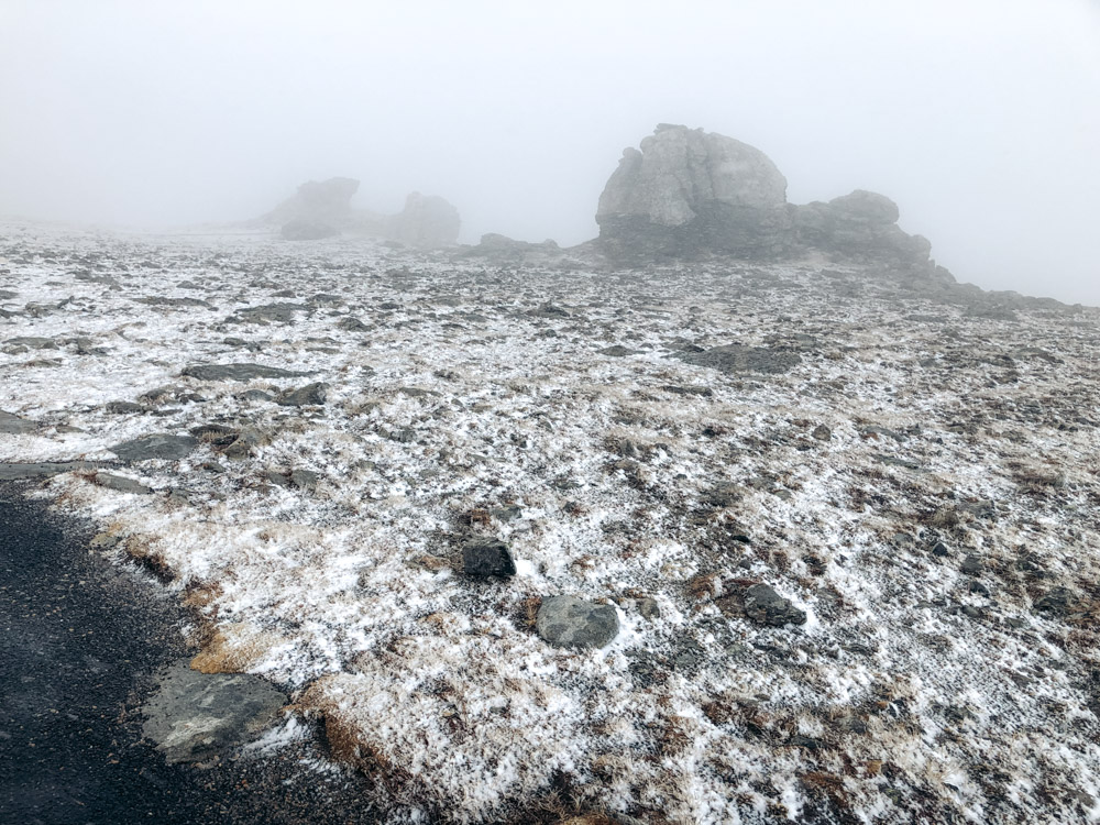
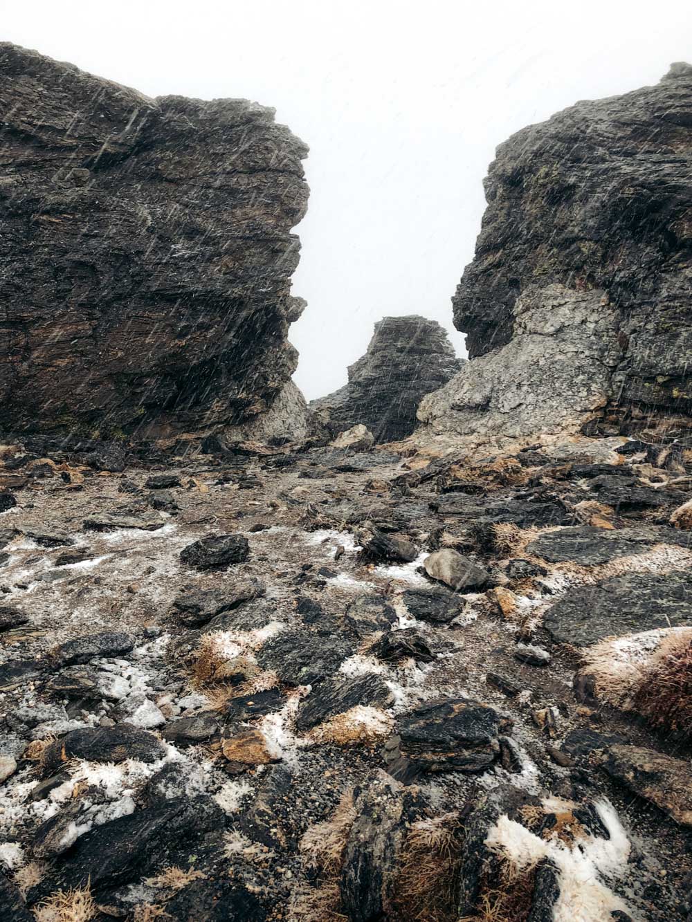
As it turned out, we didn’t even have this time. The weather in the mountains proved to be more temperamental than we’d expected. By the time we arrived at the Forest Canyon Overlook, our first destination at now fog-ceased Trail Ridge Road, hail and later the snow were slowly but surely taking over the rain.
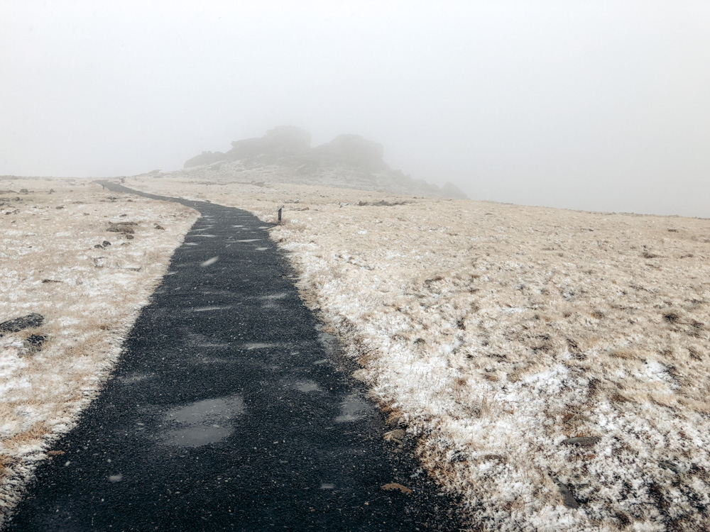
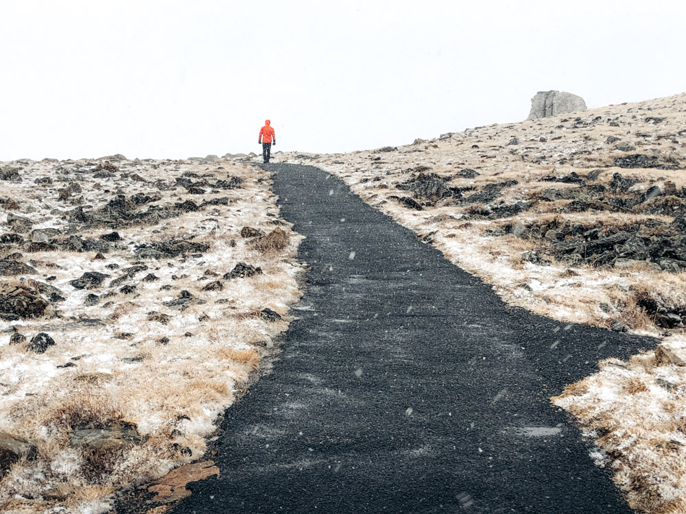
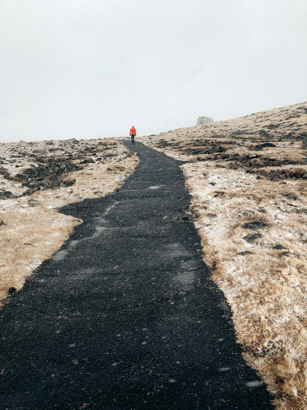
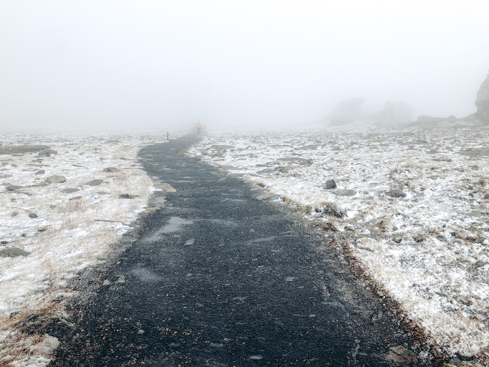
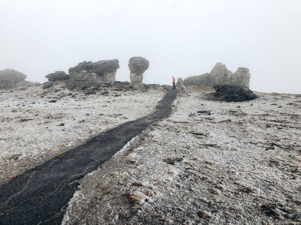
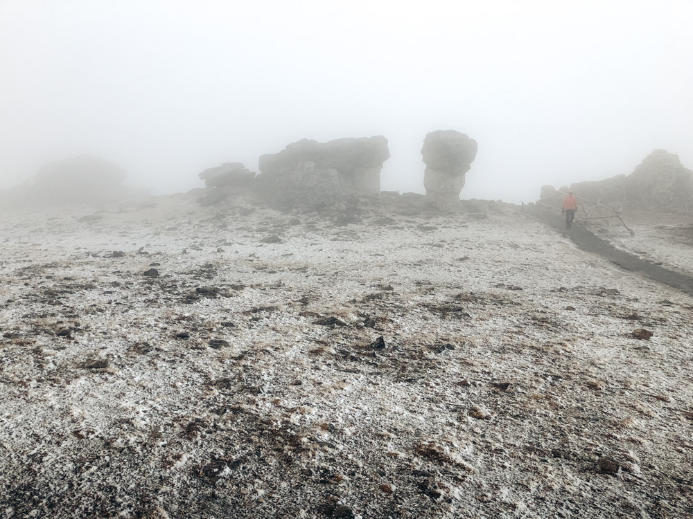
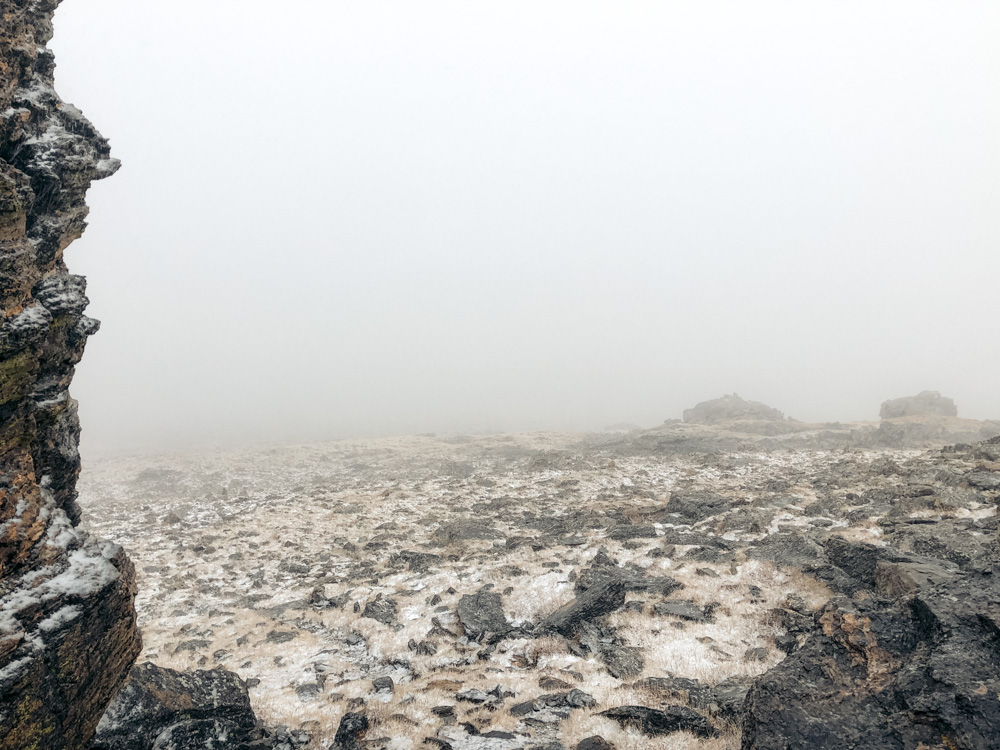
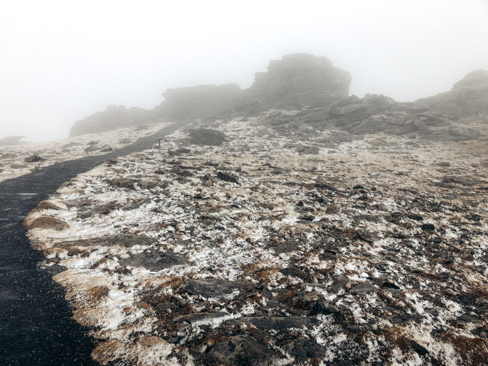
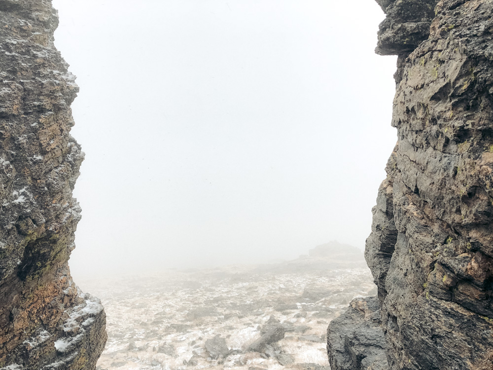
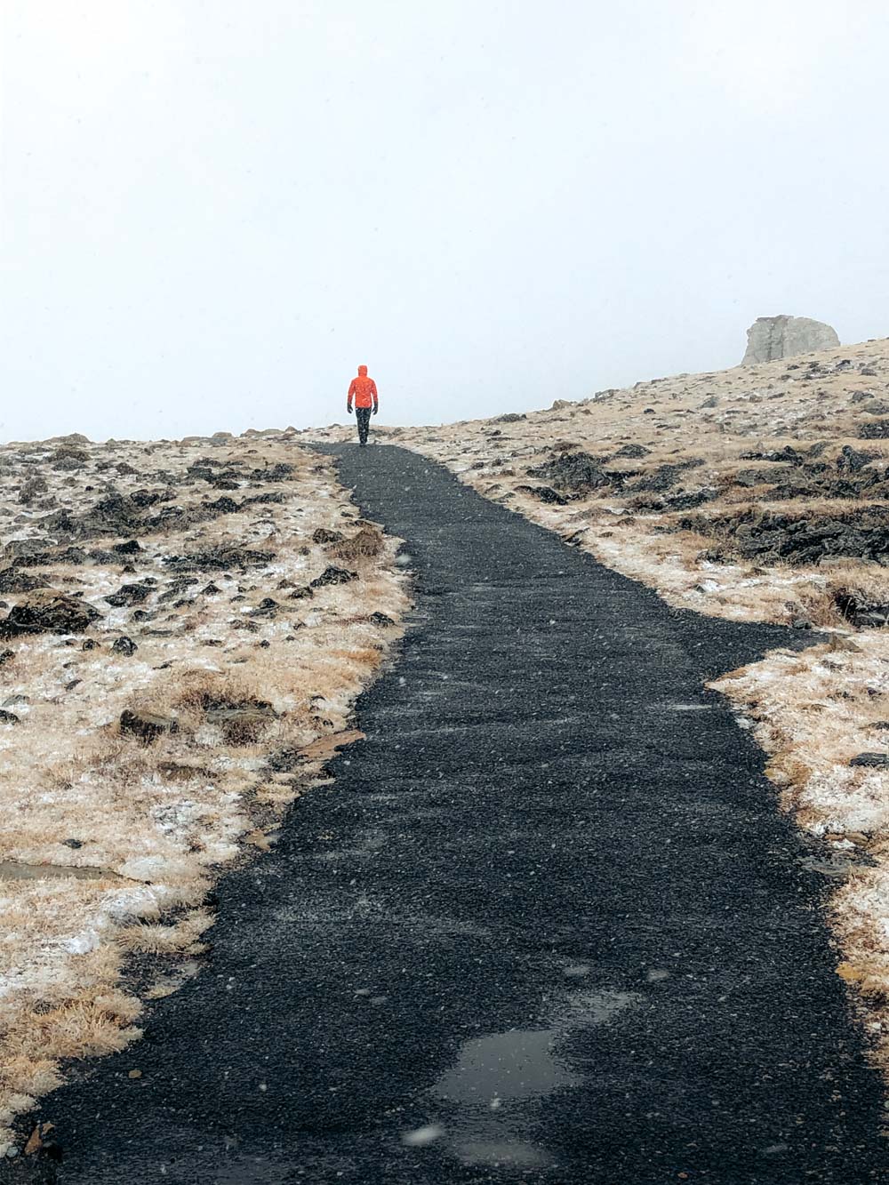
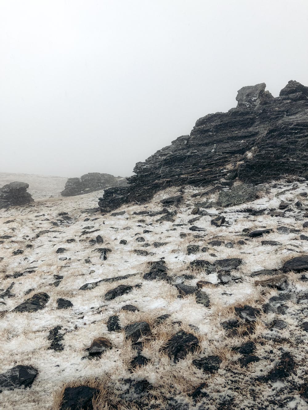
We managed to drive a little bit farther up. Somehow, encouraged by a silent presence of a random traveler, I did hike along the Tundra Communities Trail. But that was all we could do in the Trail Ridge Road area. The visibility was poor. The snow was getting thicker and heavier.
Unplanned Closure
It wasn’t even 4:00 p.m. when we exited Trail Ridge Road, but park’s rangers already closed the highest sections of the route. Several cars, slowly emerging from the fog, were returning to the lower elevations. The traffic in the opposite direction was put, as it was clear at this time, on a months-long halt.
We were so close to being those travelers that hoped for a sudden road opening on the other lane of the route. Yet thanks to that short note at the Bear Lake ranger station, we were able to squeeze the Tundra Communities Trail hike into our Rocky Mountain’s adventures. Many more attractions along Trail Ridge Road had to wait for our next visit.
Is Tundra Communities Trail Worth It?
At one point, Roshan called me crazy for doing the Tundra Communities Trail hike in the snow. Was it worthy? He might have been right. With the gusty wind blowing faster than you could move your legs and the snow covering the ground in a speedy manner, I couldn’t see much of plants or animals.
But sometimes, it’s an experience you get while on the trail that matters more than anything else. So to answer this question, yes, the hike and bizarre rock formations along the Tundra Communities Trail were worth it. Now let’s get you started on – I hope not that extreme – the hike and your own adventure along the short Tundra Communities Trail.
Tundra Communities Trail: Hike Stats
- Distance: 1-mile, round-trip hike
- Location: Rock Cut
- Trailhead Elevation: 12,050 feet
- Elevation Gain: 260 feet
- Difficulty: Easy
- Time: 20-30 minutes
TUNDRA COMMUNITIES TRAIL HIKE
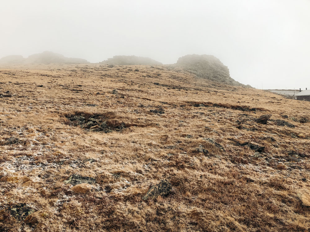
The alpine Tundra Communities Trail is the first proper hike to undertake while driving along Trail Ridge Road from Estes Park, set on the eastern side of the park. As the name indicates, the trail runs through an open alpine tundra, slowly unveiling its flora, fauna, and the untamed weather.
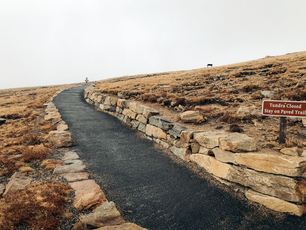
The paved path with an unmissable sign “Tundra Communities Trail” starts behind one of the two restrooms. A small parking lot aligns the side of the road nearby.
TIP: Right from the start, the trail climbs uphill, steadily gaining even more elevation on top of the headache-causing 12,050 feet above sea level. Walking farther uphill may get hard even for hikers acclimated to the high altitudes. Just persevere and do this part of the Tundra Communities Trail hike as slowly as you need.
Trail Overview
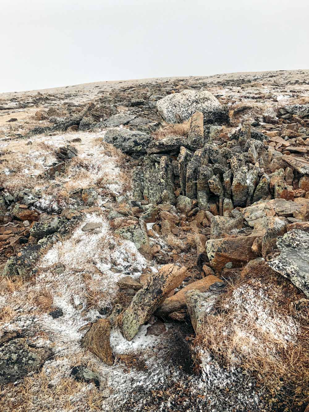
Roughly 0.2 mile into the hike, the Tundra Communities Trail levels out. The path still aches to run uphill. But the elevation gain is practically unnoticeable here. Shortly after this point, a side path forks from the trail and veers to the right to Mushroom Rocks.
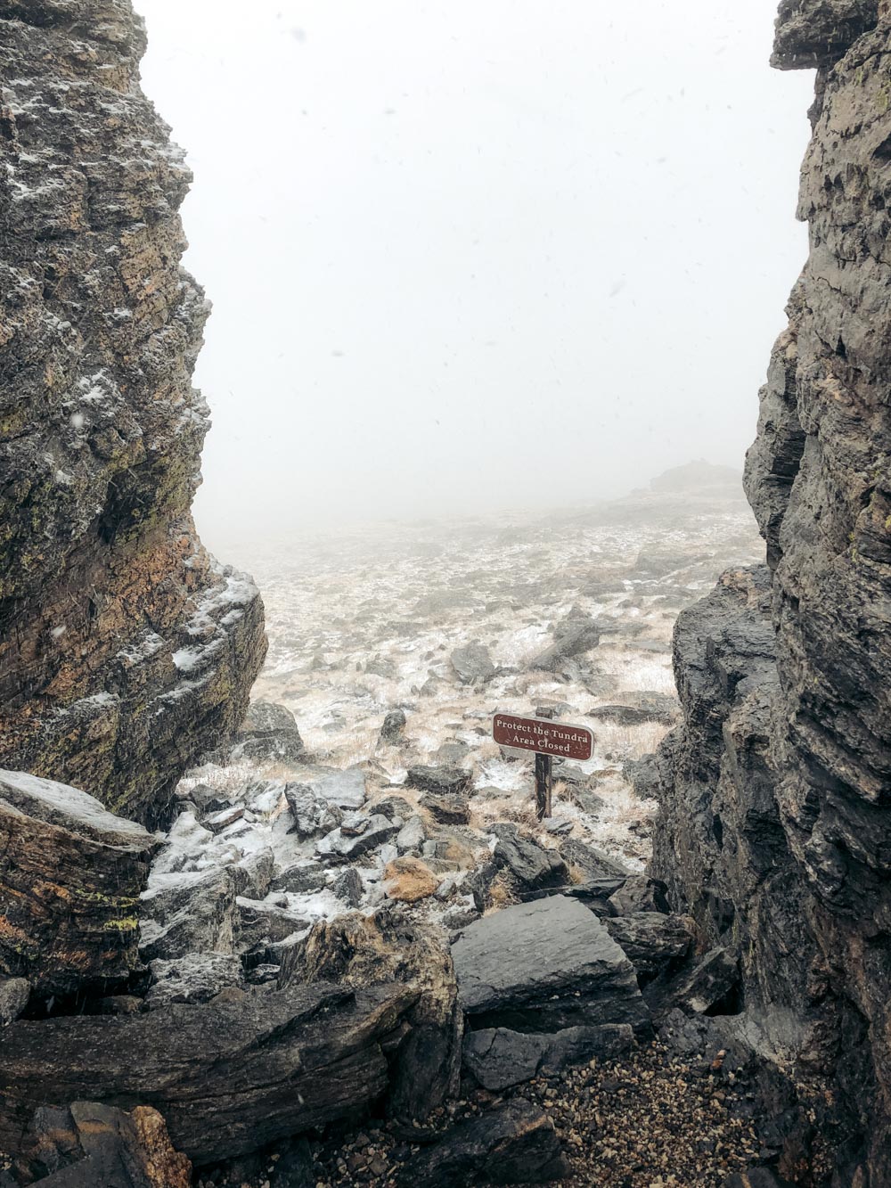
Offering the first drastic resonance to the seemingly monotone surroundings, the formations, however, are as fragile as the rest of the tundra. The rangers often linger around this area to discourage the rebellious hikers from climbing the rocks.
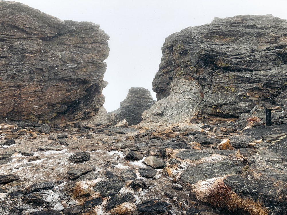
Permitted climbing opportunities arise at the end of the Tundra Communities Trail hike. Here at the Toll Memorial with a plaque engraved in one of the two rocky pillars with a “hollow” in between, you can finally unslave your adventurous spirit. The memorial is dedicated to Roget Toll, the mountaineer and former superintendent of Rocky Mountain National Park.
Views along the Trail
Once you complete the Tundra Communities Trail hike with the triumphant climb, take time to enjoy panoramic views of Longs Peak, Old Fall River Road, and the Alpine Visitor Center from the top.
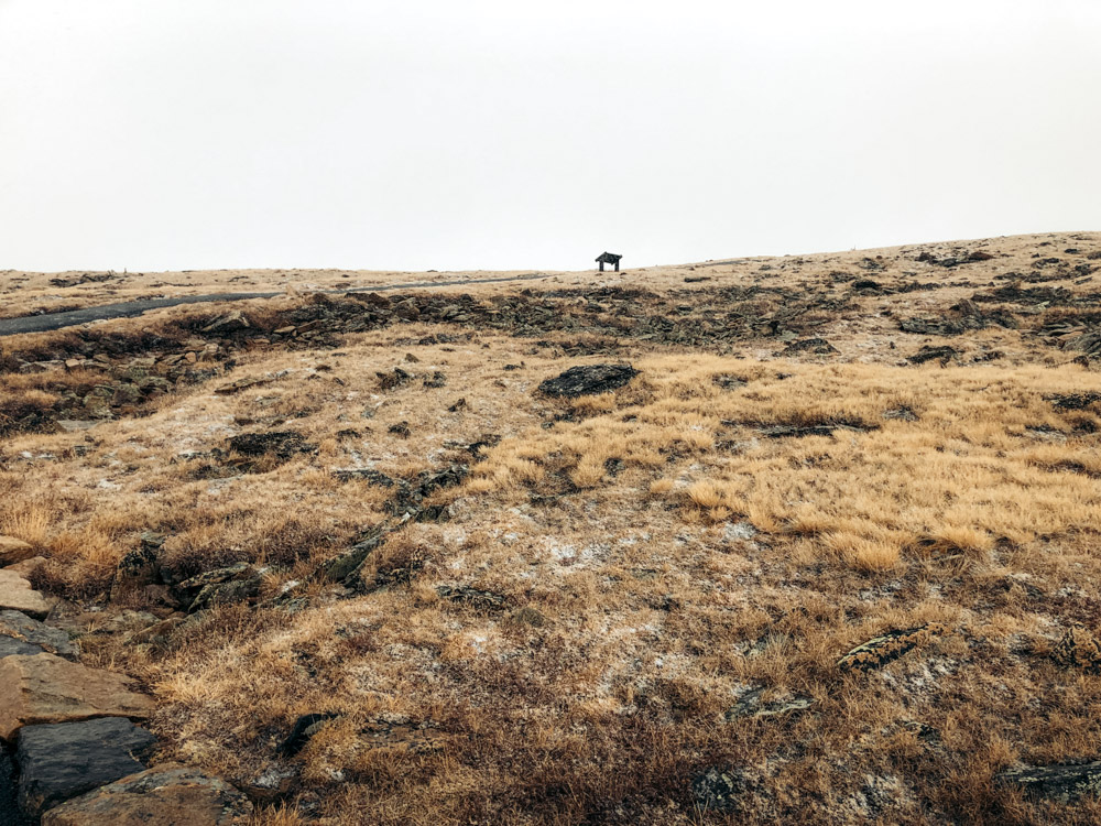
Apart from the two rocky obstructions (Mushroom Rocks and the Tall Memorial area), the Tundra Communities Trail is dotted with interpretive sign panels. Longing for the warmth of the car, I didn’t bother to read all of them on the trail. Yet taking quick pictures with the intention to go through them later turned out to be such a useful idea.
For those who hike along the Tundra Communities Trail in more favorable weather conditions, the signage provides a great deal of interesting facts about the area. Furthermore, it serves as a valid excuse to slow down, especially at the steepest stretch, without looking way out of shape.
Tundra Communities Trail: Location and Directions
The Tundra Communities Trail nestles at Rock Cut, almost at the top of Trail Ridge Road. In fact, drive west for another 4.1 miles and you reach the Alpine Visitor Center with the Alpine Ridge Trail, another epic hike along the scenic route.
From Estes Park, drive along US-34 W/Trail Ridge Road for 21.7 miles until you reach the trailhead.
If you drive from Grand Lake, follow US-34 E/Trail Ridge Road for nearly 27 miles (50 minutes) before starting your Tundra Communities Trail hike.
4 Things that Set Tundra Communities Trail Apart
4 significant things or problems… It depends on how you look at them. Yet the Tundra Communities Trail certainly stands out from other hikes in Rocky Mountain National Park. Here are some distinctive features that make this area so special.
- 35% less oxygen. Located at 12,050 feet above sea level, the Tundra Communities Trail can be a challenging hike. The oxygen level is lower at this altitude, which makes breathing and walking harder.
- Frost prevails most of the year. The summer in the alpine tundra is short, windy, and cold. While the rest of the national park soaks up the pleasant sun’s warmth, the frost resides along the Tundra Communities Trail most of the year. Yet even this “ruler” needs a vacation from time to time. Offering some relief to heat-loving hikers, it evacuates the area for approximately 40 days a year.
- Colder weather pertains. The gusty wind, however, never leaves this alpine realm. The cold weather is typical for the Tundra Communities Trail area even during the warmer months. The temperatures linger below freezing for nearly 6 months afterwards.
- Trees don’t grow in the alpine tundra. You can find neither a shady spot on a sunny day nor a shelter from the rain while hiking the Tundra Communities Trail in fall. In fact, the alpine tundra reigns over the region where the trees can’t survive. In Rocky Mountain National Park, this expanse begins at elevations between 11,000 and 11,500 feet. Instead of the trees, short plants cover the ground, providing enough food for tundra-dwelling animals.
Flora and Fauna
Dense turfs of sedges and short grasses represent the flora of the alpine tundra. If you look closer, you can distinguish some unique plant life among the thick, ankle-long “cover”. Interestingly, these plants don’t just survive, but thrive in such a harsh environment.
In the alpine tundra, while the wind blows at 40 miles per hour at eye level, at the foot level it barely speeds more than 3 miles per hour. This feels like a breeze for the peculiar alpine tundra vegetation. So much so that even some wildflowers, such as alpine sunflowers, find this surroundings quite enjoyable to flourish.
Following their food sources, elk migrate onto the tundra in summer to graze on its vast meadows. Ravens, hawks, and coyotes can also be encountered in the area at this time. But when the weather changes and the snow covers the ground, these animals drift back to the places where the food is still in abundance.
Pikas, ptarmigans, and marmots, though, don’t want to get bothered with migrating from one place to another. Able to feed themselves on what the tundra has to offer, they reside in the area all year round.
History in a Nutshell
Although the Tundra Communities Trail is paved and easy to hike nowadays, the place, although hardly trodden, was an important migratory route centuries ago. It’s believed the Ute Indians had traveled across the vast wilderness in the east to west direction way before the area was recognized as a national park.
Since becoming a protected area, the Tundra Communities Trail went through a series of changes. This time, the major improvements occurred in the name department. The hike that is known as the Tundra Communities Trail was called the Toll Memorial Trail. At some point, it also adopted the name of the Tundra Nature Trail.
There is no guarantee that the current name won’t evolve further in the future. What’s obvious, many travelers dislike all of the previous names. Nevertheless, this hike, whether you call it the Tundra Communities Trail or simply the Tundra Trail, can hardly ever disappoint.
The Best Time to Hike the Tundra Communities Trail
The Tundra Communities Trail is open for hiking for a very short time. Normally, Trail Ridge Road opens sometime at the end of May and astounds its visitors until early October. The rest of the year, the area remains closed to all vehicles. The opening and closing dates, however, change depending on the weather conditions. So be sure to check for updates before planning your hike.
Yet even during the busy summer season, the Tundra Communities Trail hike doesn’t cease to surprise with its weather instabilities. The temperature rarely reaches 70 degrees Fahrenheit. Even if it does, the wind is so cold that you want to put on a warm jacket or coat.
Afternoon thunderstorms with lightning and sometimes hail further contribute to the unpredictability of the Tundra Communities Trail hike in summer.

Things to Know before Hiking the Tundra Communities Trail
Stay on the Paved Path
Hiking off the official Tundra Communities Trail is prohibited. The uneven and in some places rocky area may look impregnable. In reality, though, it’s part of a fragile environment that needs protection. Do your part in preserving the Tundra Communities Trail by adhering only to the designated route.
Dress Warmly
The alpine tundra is colder than the areas of the park at the lower elevations. So be sure to pack some layers even if you hike the Tundra Communities Trail in summer.
Less Oxygen at the Higher Elevations
Therefore, hike slowly and read the signage along the Tundra Communities Trail to give yourself extra reasons to rest. Walk at your pace. If you need 1 or 2 hours to complete the hike, just do it.
Ongoing Parking Issues in Summer
The parking lot at the Tundra Communities trailhead is not able to accommodate all the summer visitors. So either hike early in the morning or late in the afternoon to ensure you have a spot to park.
Alternatively, you can follow our lead and hike along the Tundra Communities Trail during the off-season. Based on our experience, in early October, the parking lot is practically empty. And so is the trail. The nasty wind and moody weather, however, present their own share of obstacles.
Stay away from Lightning
Refrain from hiking during the thunderstorm when the lightning brightens the sky. Return to your car immediately.
Wear Sunscreen and Sunglasses
Protect your skin from direct sunlight in the open alpine tundra, which in essence the Tundra Communities Trail is.
More Adventures in Colorado
- EPIC HIKE IN ROCKY MOUNTAIN: Bierstadt Lake Trail from Bierstadt Lake Trailhead
- EASY HIKE IN THE PARK: Sprague Lake Trail: the Easiest Hike in Rocky Mountain
- MUST-SEE CITIES IN COLORADO: Highlights of Denver and Boulder in One Day
- COLORADO ROAD TRIP: Denver to Rocky Mountain Road Trip
- DENVER DAY TRIPS: 9 Beautiful Day Trips and Weekend Getaways from Denver