The Fire Wave hike or the White Domes Trail? We did both. But the Fire Wave, one of the most beautiful trails in Valley of Fire State Park, Nevada, had to be our first hike for a reason.
Last updated: April 17, 2026

Hiking in Valley of Fire State Park
One of the most exclusive features of Valley of Fire State Park, the Fire Wave Trail is a must-do hike for every outdoor adventurer. The place of rare beauty. This is how you would describe the Fire Wave. truthfulness of this statement.
Interesting Thing: The natural “painting” was one of the best-kept secrets of Nevada just a few years ago. But with all good things, more and more hikers stumbled upon this secret location and shared it with their fellow adventure seekers. The rest is history.
Need to Know: Nevada’s colorful Fire Wave is smaller and less “mysterious” than the elusive Wave in Arizona. Yet it has its own charm, with all those distinctive shapes and pastel hues.


What is Fire Wave?
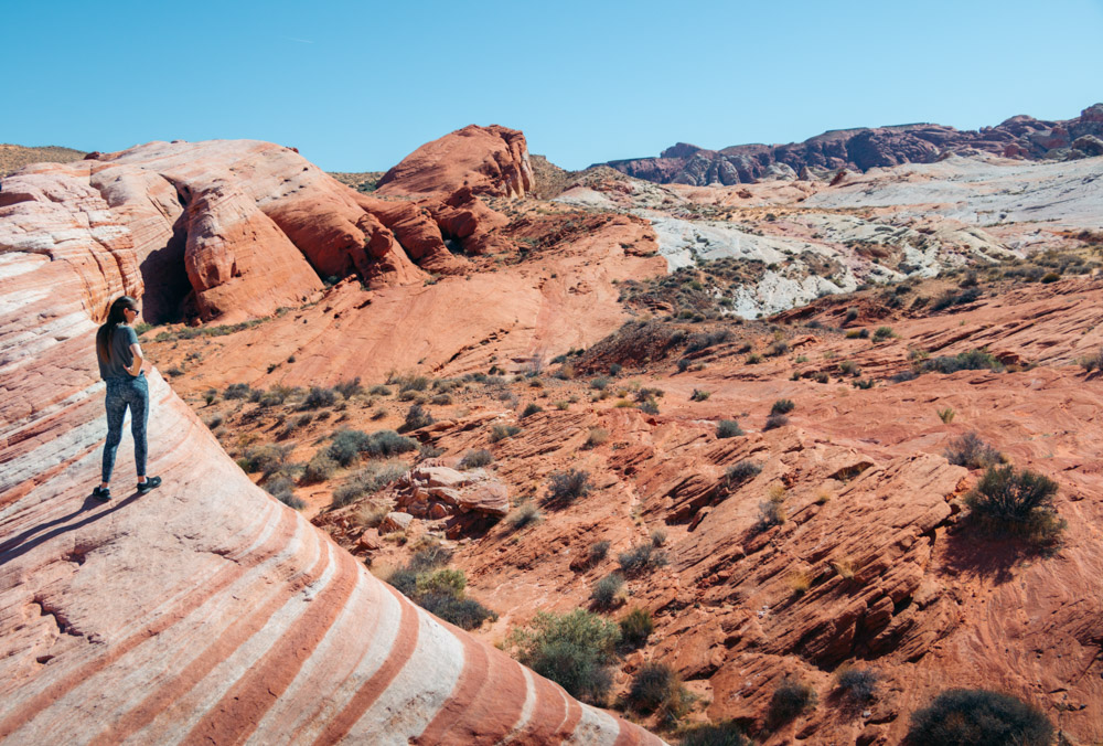
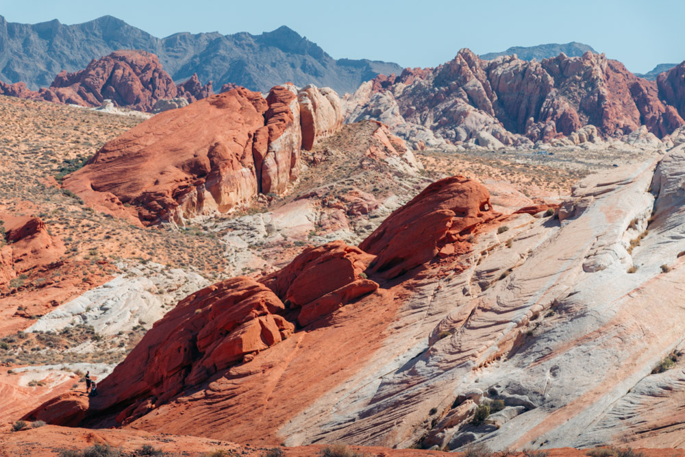
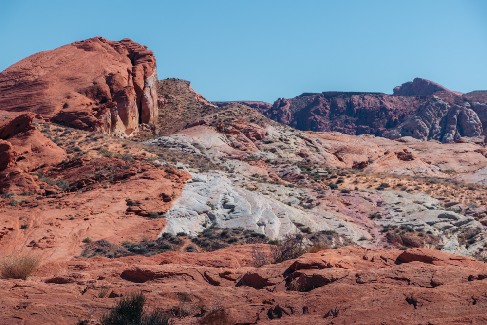
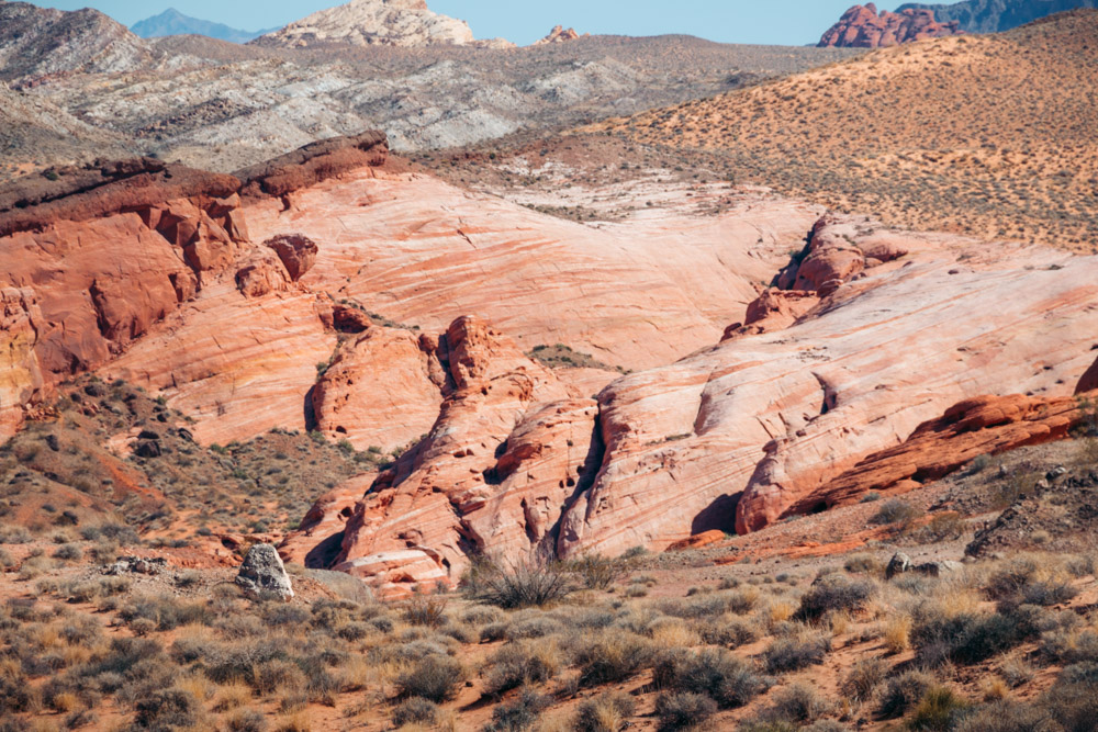
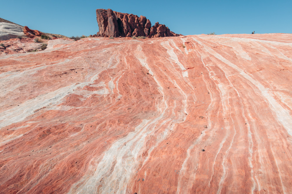
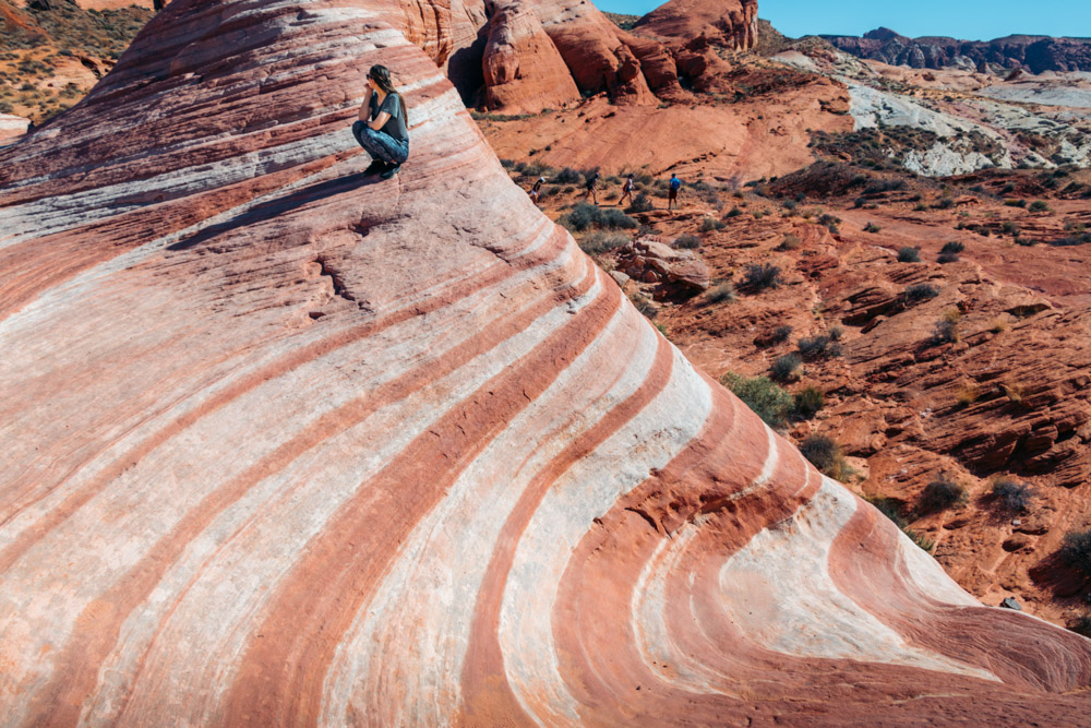
To put it simply, the Fire Wave hike takes you to another world. Running past different rock groups, the trail comes to an end at a stunning sandstone formation. A bowl-shaped depression with two rising points resembles an ocean wave. Each part of this natural masterpiece adorns itself with swirling lines that range from beige to red, white, and pink shades.
Truth be told, the actual Fire Wave section is a rather small, yet essential part of the hike. At one point of your hike, you may even start wondering if you have already reached the Fire Wave and walked on one of its gigantic swells without realizing it.
A colorful slickrock that leads to the natural wonder indeed resembles a massive desert wave you can ride without a surfboard. But be patient. The Fire Wave comes into view as you get closer to the end of the trail.
FIRE WAVE TRAIL
- Distance: 1.5-mile round-trip trail
- Elevation Gain: 174 ft
- Difficulty Level: Easy to Moderate
- Time: 40-60 minutes
Fire Wave Hike
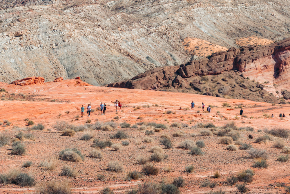
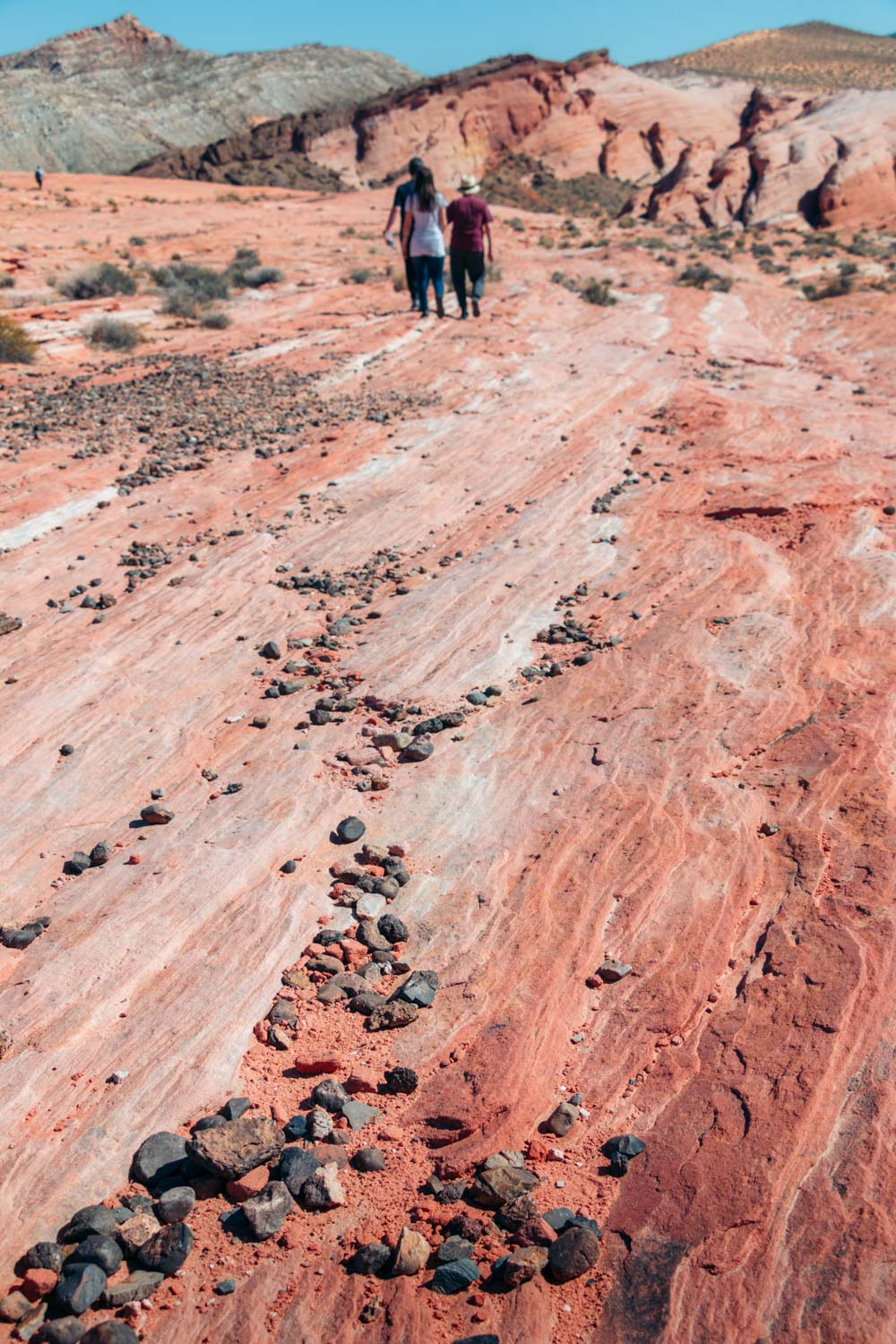
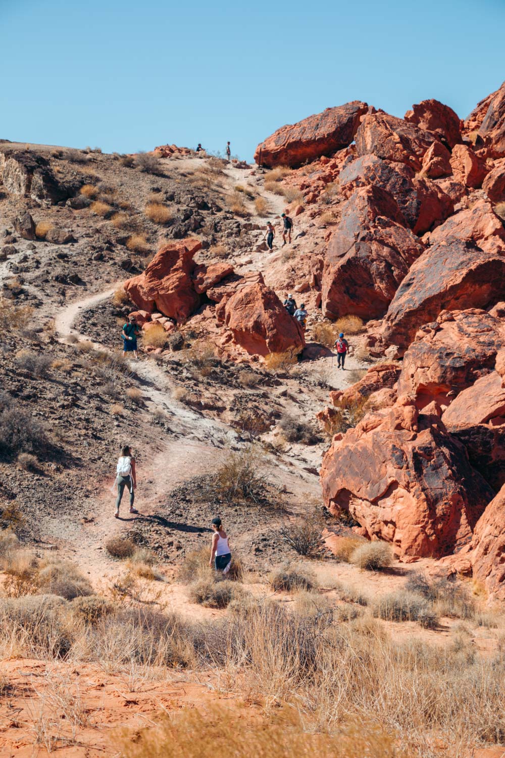
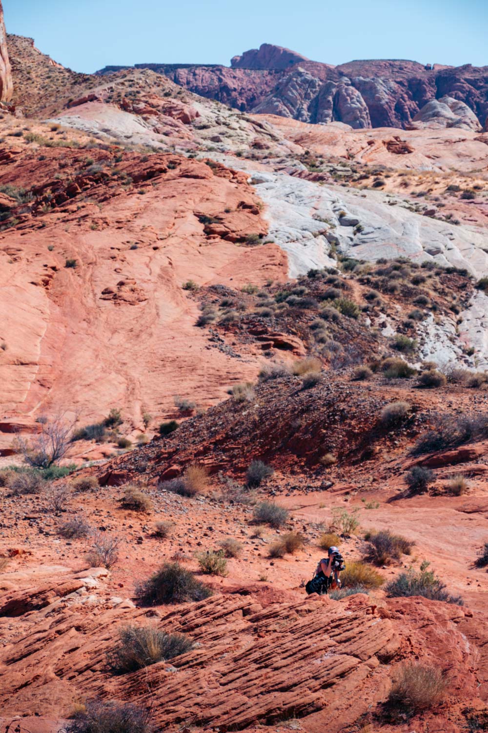
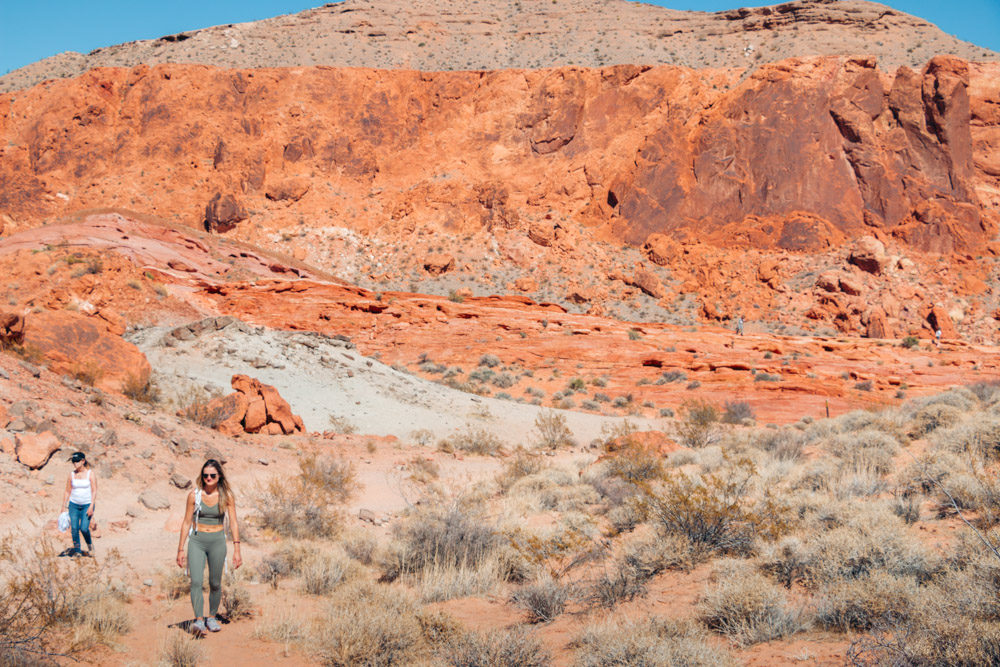
The Fire Wave Trail starts on a rather sandy note. Although well-marked and easy to find, the path is sandy at the beginning, making hiking difficult. As you move along the trail, hard-packed sand and eventually rocks take over. From now on, the hike to the Fire Wave becomes quite enjoyable.
Apart from the sand, a steep descent at the start of the hike tries to keep some easy-to-frighten travelers away from the irresistible magic of the Fire Wave. Brave this part of the trail and continue on toward a long steep ridge. Here, the trail curves to the right and the sand gets packed.
Fire Wave Hike: Unofficial Trails
Before you reach this point, though, a few easily recognizable trails at the bottom of the first dip can misguide you. These paths lead up the hill, across the slickrock, and all the way to the Fire Wave, leaving behind a good portion of the official trail. Many people, including us, get confused by the presence of not one (as the sign at the trailhead insists), but several trails.
Interesting Fact: The Fire Wave hike wasn’t marked on any park’s maps until recently. The place was also less popular back then. Yet it never failed to allure the most adventurous visitors that were making their own trails when hiking to the Fire Wave. Some of these paths still exist and suggest different ways of getting to the colorful rock formation.

Do the Right Thing – Use Official Trail
Valley of Fire State Park encourages its guests to hike to the Fire Wave using the official trail. Despite its undeniable power, nature still needs protection. And so does the isolated colorful Wave. Thus, avoid the temptation of shortening your Fire Wave hike and follow the well-marked trail.
As you walk past a tall block stone called Gibraltar Rock, the path curves to the left. From this point, the striped slickrock comes into view and becomes even more visible as you approach the Fire Wave. Walk on the slickrock (be careful, it may be slippery) until you reach the coveted wave-shaped formation.
TIP: The Fire Wave Trail is exposed to the sun. During the day, it gets extremely hot. So drink a lot of water or plan your hike in the morning or later in the afternoon. Consequently, don’t hike the Fire Wave Trail any time from sunset to sunrise to avoid any accidents.
The Story of the Fire Wave
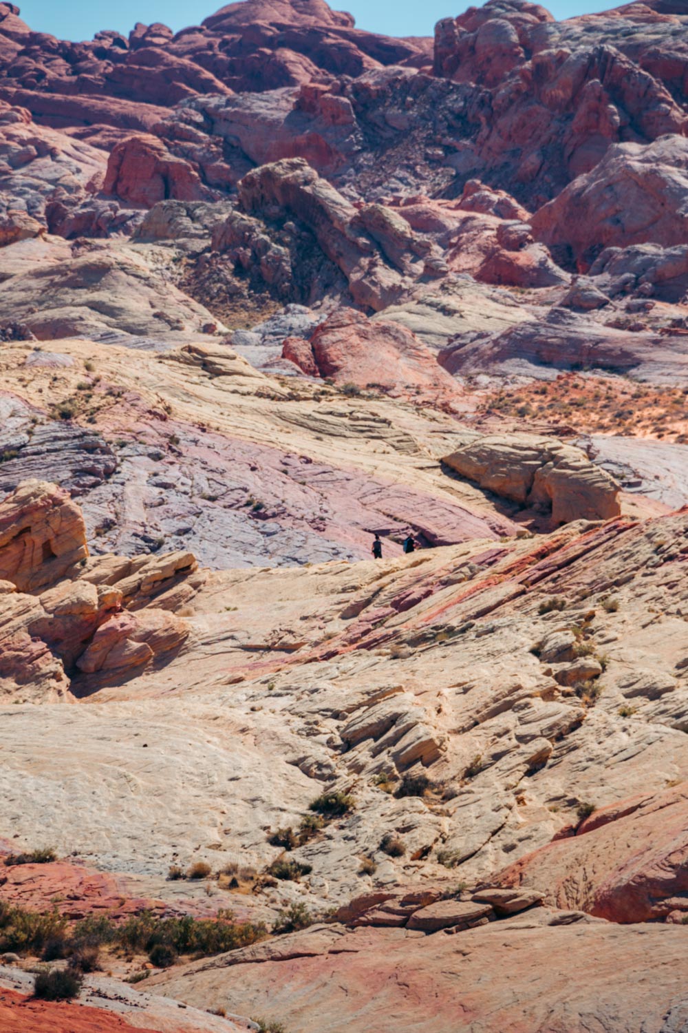
If you could see only pictures of the Fire Wave without going for a hike, you would think that somebody painted the prominent beige and red lines on the surface of the already remarkable rock formation. That somebody, or rather to say the forces of nature, indeed did a remarkable job.
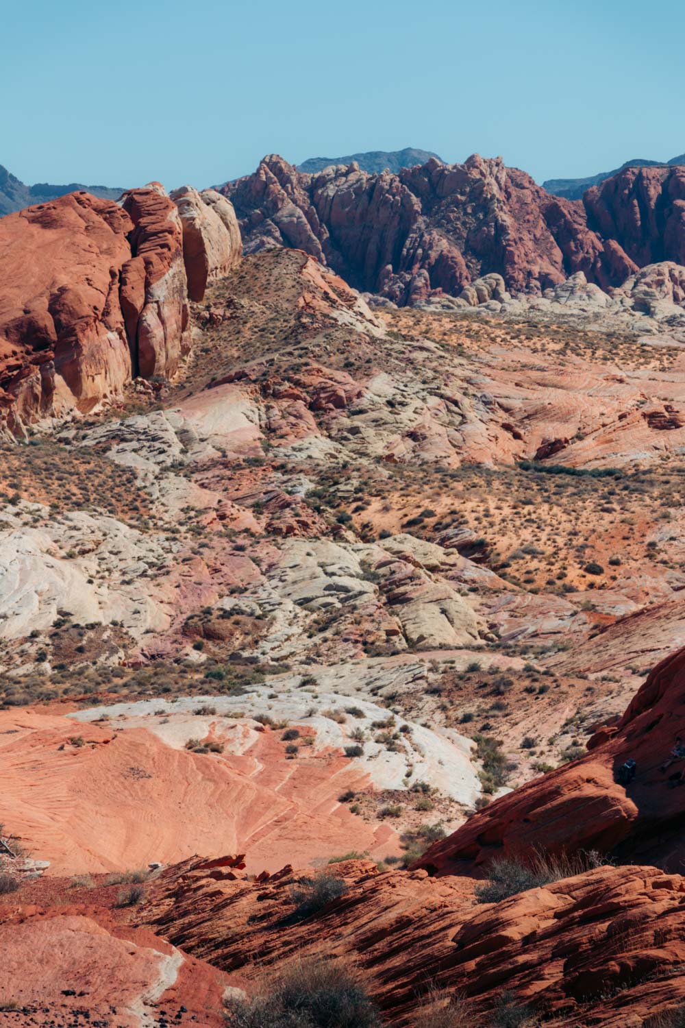
Similar to many other sites in Valley of Fire State Park, the Fire Wave was a sand dune once. Constant changes in the park’s geology that date back nearly 150 million years paired with the miraculous effects of wind, rain, snow, and ice have created the landscape we see today.
Why Should You Hike the Fire Wave Trail?
While the colorful rock formation intrigues the majority of the park’s visitors, only a few adventure seekers still ask why they should hike the Fire Wave Trail. The answers to this question are plentiful. Let’s start with the most common reasons why you should hike to the Fire Wave.
1. The Most Recognizable Feature in the Park
With its awe-inspiring, colorful patterns and intriguing shapes, the Fire Wave is one of the most favorite hikes in the area. Thousands of visitors flock to this secluded part of the park to feast their eyes on the distinct rock formation.
Even park’s rangers can’t resist the natural beauty of the Fire Wave, constantly placing the picture of it on the front page of the park booklet.
2. Easy Hike
Have you ever hiked in the desert? It’s hard to call Valley of Fire State Park a desert, but in essence it’s a rocky wasteland. Hot summers and practically no shade prevail here. Consequently, hiking in this region has its obstacles.
Yet while some trails overwhelm with their less than welcoming conditions, the Fire Wave Trail is a piece of cake. Some ascents and descents still exist. But there is hardly anything here one can’t handle.
3. Nevada’s Bucket List Destination
The Fire Wave is regarded as one of Nevada’s bucket list destinations. You know it’s true when you see the remarkable rock formation in person. Luckily, the state doesn’t hide its star. Located less than an hour away from Las Vegas, Valley of Fire State Park, including its exclusive Fire Wave, is a quick day trip.
4. A Wonderland for Photographers
Similar to many other natural wonders, the colorful pastel canyon stirs up the interest among photographers. The elaborate shape of the Fire Wave festooned with the red, orange, and beige stripes accentuates the natural beauty of the park and can be captured from many unique angles.
How to Get to Fire Wave
As we said before, the Fire Wave Trail is a beautiful day trip from Las Vegas. Upon entering the park, drive along a well-maintained paved road to the Fire Wave trailhead. The trip is approximately 30 minutes long.
From West Entrance
Upon entering Valley of Fire State Park, continue on along Valley of Fife Highway for 3.5 miles. From here, turn left, following a sign for the Visitor Center and Mouse’s Tank Road. Another intersection follows shortly after. Keep left to continue on on White Domes Road. Bypass the Visitor Center and drive for about 3.7 miles to parking lot #3. Park here and walk across the road to the Fire Wave trailhead.
From East Entrance
If you enter Valley of Fire State Park from the East Entrance, drive 3.3 miles to the intersection where White Domes Road starts. Turn right and follow the road until you reach parking lot #3. Cross to the other side of the road and hike to the Fire Wave, located 0.75 miles away from here.
The Best Time to Hike to the Fire Wave
The Fire Wave Trail is exposed to the sun. There is no shade. The area can get extremely hot. In the summer, the temperatures can reach well over 100 degrees Fahrenheit. Thus, early mornings and late afternoons are the ideal times to hike to the Fire Wave.
Late fall, winter, and spring bring cooler weather and are considered the best seasons to embark on this alluring venture.
Annual Trail Closures: The Fire Wave Loop (the trail includes Fire Wave, Seven Wonders, Pastel Canyon, and Pink Canyon) along with some other scenic trails such as White Domes Loop are closed from mid-May until October. The park states that during this time fatalities and the need of medical assistance and search and rescue missions increases. To protect its visitors and staff, the park decided to suspend access to these areas.
How Much Time Do You Need to Hike the Fire Wave Trail?
Normally, the hike to the Fire Wave takes 1 hour. The sign at the trailhead also estimates it as the approximate time to complete the journey. In reality, though, visitors stay on the trail from 40 minutes to 1.5 hours. It took us about 20 minutes to hike to the Fire Wave from the start of the trail. We spent more time staring in awe at the site and exploring several rock formations nearby than walking.
Things to Know before Hiking the Fire Wave Trail
- Wear appropriate hiking gear. While the majority of visitors find the Fire Wave hike easy, minor accidents can still happen. Thus, be sure to wear good, non-slip shoes when walking up and down the slickrock. Hiking sticks may also come in handy for those who need extra support while hiking uphill.
- Bring enough water. Drinking enough water is essential to keep your energy level up. You may want to double your water intake when hiking to the Fire Wave during the warmer months.
- Use sunscreen and hats. Apart from keeping yourself hydrated, take care of your skin. Use sunscreen and wear a hat when hiking to the Fire Wave.
- Make your Fire Wave photography epic. For the best photos and vivid colors, hike to the Fire Wave in early evening or late afternoon.
- Leave your drone at home. No drone photography is allowed in Valley of Fire State Park. Violators can be fined and in rare occasions banned from the park.
- Use restrooms at the White Domes Day Use Area. The area near the Fire Wave trailhead doesn’t have any facilities. The closest restrooms are located at the White Domes area, about a mile away.

The Best Trails to Hike Near the Fire Wave
The stunning Fire Wave is not the only trail you want to explore in Valley of Fire State Park. With a plethora of scenic paths, the area is yet to surprise you. Start exploring the park with these closest hikes.
White Domes Trail
Consisting of a slot canyon, sandstone formations, and open desert, the White Domes Trail is the second popular hike in Valley of Fire State Park. Similar to the Fire Wave, this 1.25-mile loop has a few accents and descents that may be difficult for small kids and people with disabilities. Other than that, the trail suits all activity levels and takes on average 45 minutes to complete.
Rainbow Vista Trail
Nestled about 3 miles away from the Fire Wave, the 0.7-mile round-trip Rainbow Vista Trail offers an easy hike and panoramic views of the colorful rock formations.
Pastel (Pink) Canyon Trail
The Pastel (Pink) Canyon Trail is yet to gain its popularity and eventually an official trail on the park’s map. As of today, this 0.6-2-mile path (it depends how far you want to go) is of the interest of mostly locals and adventurous hikers. Needless to say, the area is regarded as one of Nevada’s most stunning geological displays.

Frequently Asked Questions
How long is the Fire Wave hike?
According to the sign at the trailhead, the Fire Wave Trail is a 1.5-mile trail, out and back. While most articles you find online agree with this distance, a few of them still insist on different numbers. This information most likely pertains to the old, unofficial trails that should be avoided to protect the unique environment.
Who can hike along the Fire Wave Trail?
Anybody can hike the Fire Wave Trail. The path is fairly easy and suits both beginners and experienced hikers. Gradual elevation gain presents some difficulties for elderly hikers and people who have issues with breathing. Keep it slow and stop as many times as you need.
Is the Fire Wave Trail difficult?
Most visitors find the Fire Wave Trail an easy hike. The path runs through the sandy area and along some rock formations. Minimal elevation gain is present. Overall, the Fire Wave hike is ranked as an easy to moderate trail.
Can you bring dogs along to the Fire Wave?
Yes, dogs are allowed on the Fire Wave Trail and most of the other trails in Valley of Fire State Park. Be sure to keep them on leash, though, to not disturb other hikers.
Can you see the Fire Wave without hiking?
No. The Fire Wave is nestled behind a massive slickrock and can’t be seen from the road. You must dip your feet in sand first, conquer the hard-packed sand and rock formations afterward to feast your eyes on one of the most recognizable landmarks of Nevada.
Do you need a permit to hike to the Fire Wave?
Valley of Fire State Park charges an entrance fee, $10 per day ($15 for non-Nevada residents). Once you purchase your day-use ticket, feel free to explore the Fire Wave and many other attractions in the park. No other permit is required.