It was just a little bit past 8 o’clock in the morning, but all parking spaces in one of the popular hiking destinations in Glacier National Park were occupied. We drove around a few times to no avail. It looked like our hike to Avalanche Lake could not happen after all.
Last updated: May 15, 2026
Avalanche Lake Hike in Glacier National Park
Nestled a good 2 miles off the popular Going-to-the-Sun Road in the western section of Glacier National Park, Avalanche Lake has gained its reputation as one of the incredible natural wonders at the end of the trail that forks from the Trail of the Cedars shortly after it passes scenic Avalanche Gorge.
Indeed, the hike to Avalanche Lake has its own beauty. The trail runs along a raised boardwalk, through a cedar forest that reminds you of Sequoia National Park, across Avalanche Gorge, and alongside Avalanche Creek before veering into the forest, and ending at the shore of Avalanche Lake, a place of exceptional beauty and magnificence.
Avalanche Lake: History in a Nutshell
Avalanche Lake received its name in 1895. During that time, an expedition with Dr. Lyman Sperry studied the wilderness that is known as Glacier National Park today.
Bewildered by frequent avalanches sliding from the snow-capped mountains surrounding the lake, the discoverers couldn’t think of a better name. So they baptized the place as Avalanche Lake. Years later, the area became a popular hiking destination that hardly any visitors of West Glacier could skip.
HOW TO HIKE TO AVALANCHE LAKE
Avalanche Lake Hike Stats
- Distance: 2 miles from the junction at the Trail of the Cedars (You need to hike about 0.4 mile or less, depending where you start the hike, to the junction.)
- Elevation gain: 730 feet
- Difficulty: Easy
- Time: 2 – 3 hours
- Location: The Going-to-the-Sun Road in West Glacier
- Trailhead: The Trail of the Cedars/Avalanche Lake trailhead
Avalanche Lake: Trailhead and the Beginning of the Hike
The Avalanche Lake Trail is one of the must-do hikes in Glacier National Park, to say the least. The epitome of natural beauty would be the right phrase to describe the final destination. Surrounded by the snow-capped peaks with a series of waterfalls fed by Sperry Glacier, the area displays the irresistible charm Glacier National Park is known for.
Yet unlike many other roadside sites in the Going-to-the-Sun Road area, Avalanche Lake unveils its beauty only to those who are willing to hike nearly 2.5 miles one way. Sharing the trailhead with the Trail of Cedars, the Avalanche Lake Trail starts directly across the road from the Avalanche Campground. It follows the Trail of the Cedars for approximately 0.4 mile until forking to the left into the old-growth forest.
The Trail of the Cedars is well marked. You can easily reach it while driving from both the West Glacier and St. Mary/East Glacier entrances.
The Trail of The Cedars/Avalanche Lake from West Glacier
A sign showing the direction to the Avalanche Lake Trail sits 16.8 miles (35 minutes) from the West Glacier entrance. Simply follow the Going-to-the-Sun Road until you reach your destination.
The Trail of Cedars/Avalanche Lake from St. Mary Entrance
If you enter the park at the St. Mary entrance, continue driving along the Going-to-the-Sun Road for 35 miles until you see the sign. Due to many curves on the scenic drive, it takes approximately 1 hour 10 minutes to reach the Avalanche Lake trailhead from the eastern side of Glacier National Park.
Parking
The Trail of the Cedars/Avalanche Lake area has its own, rather big parking lot. And yet, finding a parking spot is often an issue during the summer season, the busiest time to visit Glacier National Park.
TIP: The parking lot gets busy fast. During our hike to Avalanche Lake on a Monday morning, it got fully packed before 9:00 a.m. Parking spaces open up periodically, when early hikers get back and leave for other sites. So if you hike to Avalanche Lake in the summer, be sure to arrive before 8:00 a.m. to claim an empty spot right away.
Alternatively, you can come back later after visiting some other places along the Going-to-the-Sun Road. The parking situation indeed looked somewhat promising a few hours later, after we finished our Avalanche Lake hike.
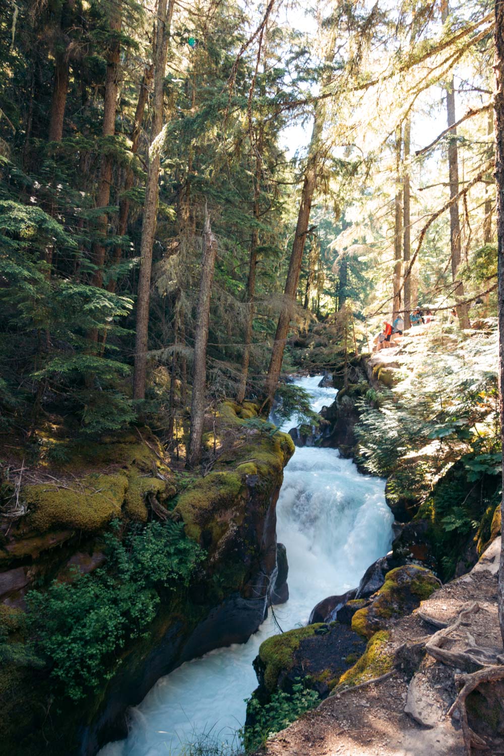
The Trail of the Cedars and Avalanche Gorge
Trail of the Cedars
- Distance: 0.7-mile, loop trail
- Elevation gain: Less than 50 feet
- Difficulty: Easy
- Time: 20-40 minutes
- Trailhead: The Trail of the Cedars along the Going-to-the-Sun Road
Hiking the Trail of the Cedars
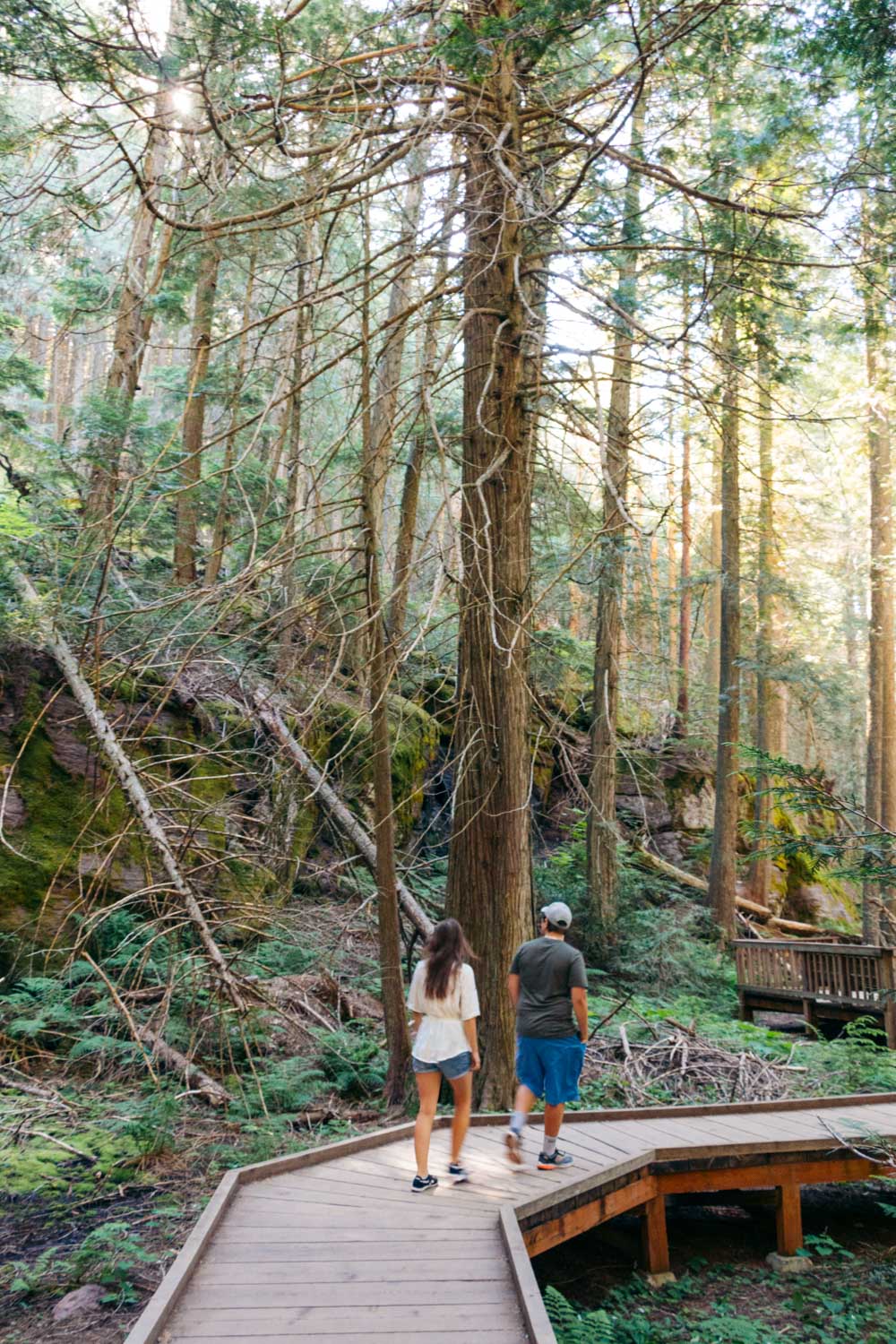
The Trail of the Cedars is a 0.7-mile loop path through a forest that consists of western hemlocks, cottonwoods, and western yews. The trailhead sits across from the Avalanche Campground. Accessible by wheelchairs and strollers, the path runs along the raised boardwalk until it reaches Avalanche Gorge.
Note: Although more convenient, the eastern side of the Trail of the Cedars is longer, but more appealing to the eye.
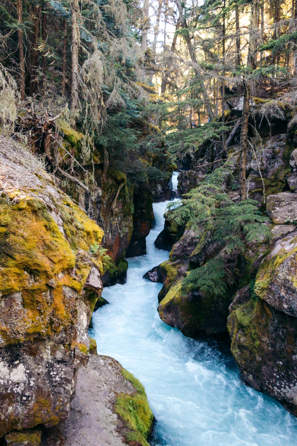
At the end of this segment of the trail, you find a footbridge across Avalanche Creek. Linger here for a few minutes to enjoy the views. To your right, streaming downhill, the creek displays its winding side, tamed by its own banks with tall trees, some of which are hundreds years old. (I could see a slight resemblance of Glacier National Park to its Washington’s sibling, Rainier National Park.)
The views to the left, however, always steal the show, offering incredible vistas of lower Avalanche Gorge. Moss-covered rocks dot both sides of the small ravine, creating a surreal environment.
The resemblance to the Pacific Northwest doesn’t escape this section of Avalanche Creek either. If you’ve ever been to Columbia River Gorge, you can’t help but now feel a longing desire to go back and explore more of Oregon’s dazzling waterfalls and moss-covered forests.
Once the nostalgic feeling subsides or you’ve had enough of Avalanche Gorge, walk across the footbridge and follow the Trail of the Cedars until you reach the Avalanche Lake Trail junction. The Trail of the Cedars swirls to the right from here. The left fork takes you to the shores of Avalanche Lake.
Hike from Avalanche Gorge to Avalanche Lake
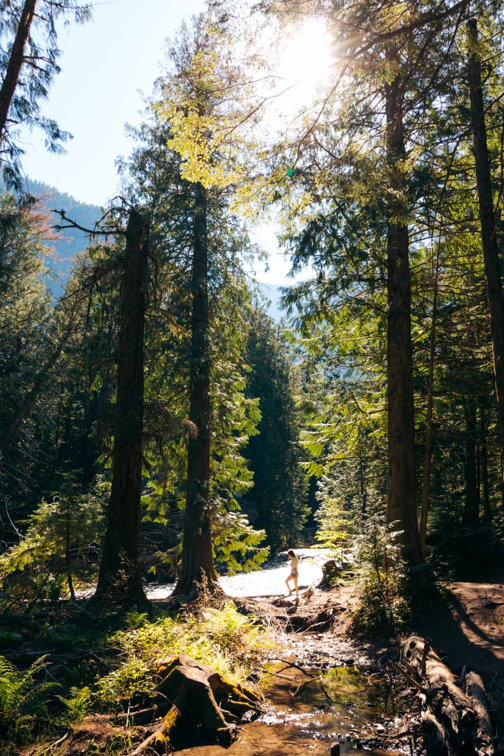
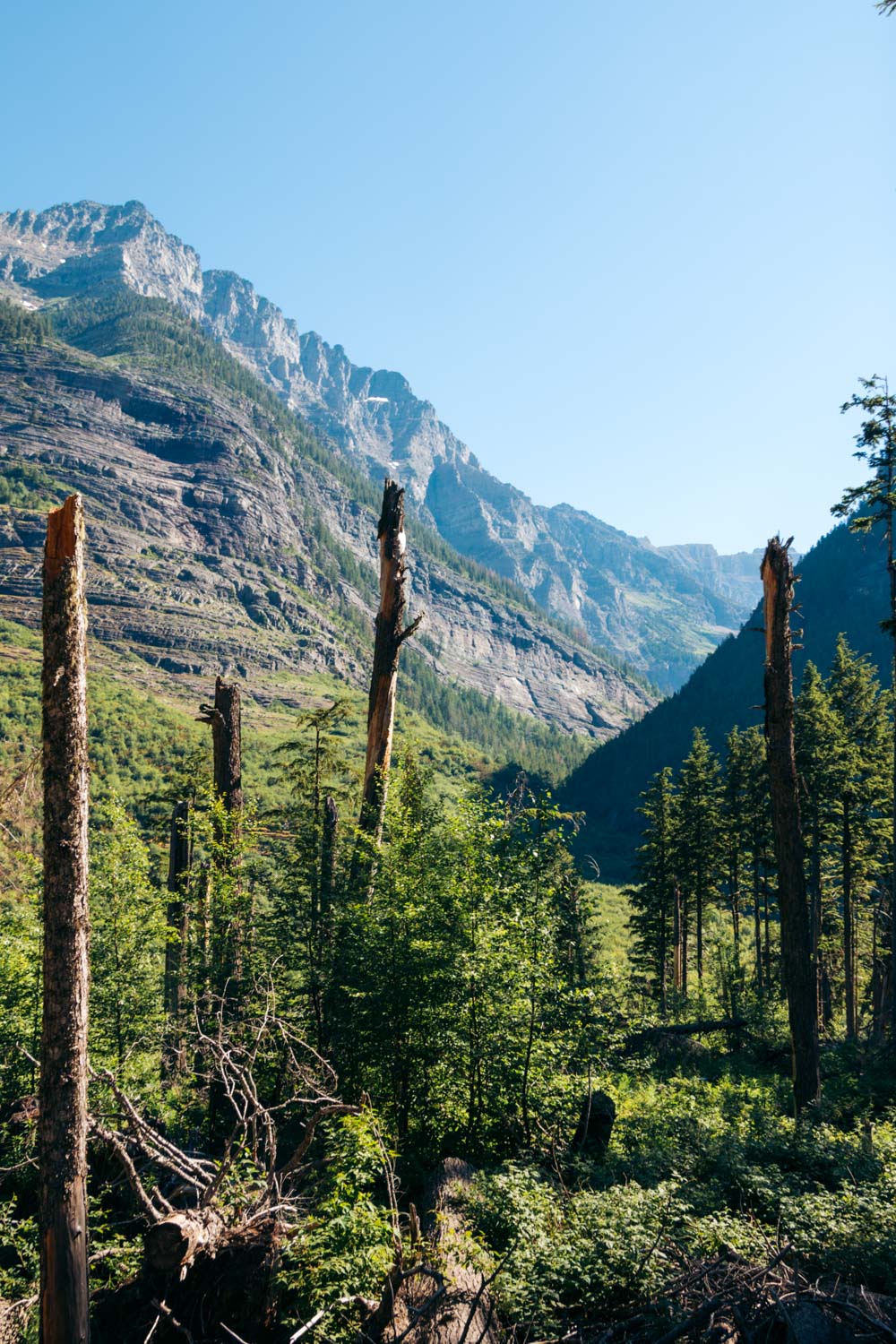
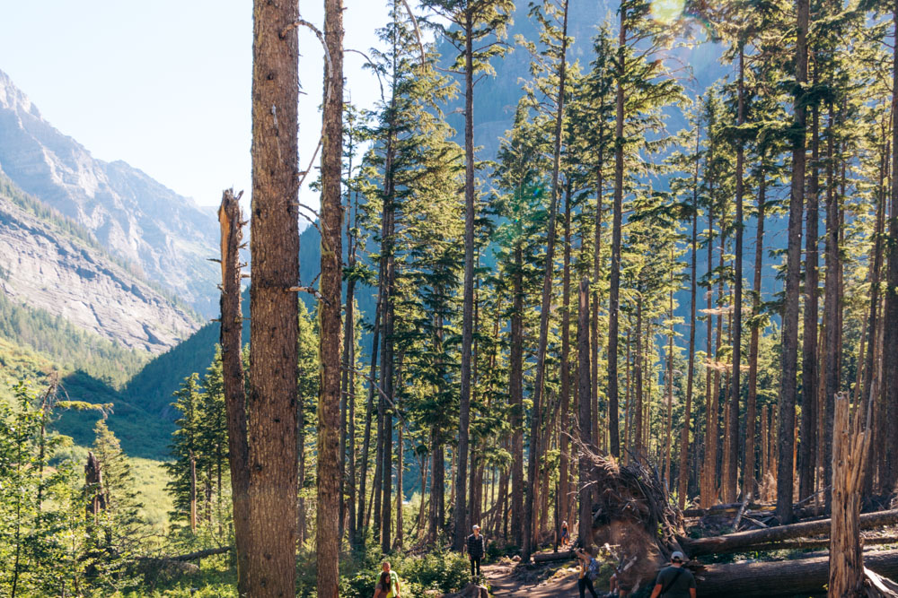
The distance from the junction to Avalanche Lake is 2 miles, one way. The journey seems long, but easy. On the other hand, the Avalanche Lake Trail is less spectacular than the Trail of the Cedars, looking rather plain among tall evergreen trees.
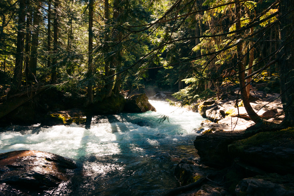
To be fair, the trail preserves its dramatic appeal for about a mile, while running alongside Avalanche Creek’s bank. The visual splendidness, however, comes to an abrupt end when the path sprints to the right and dives deeper into the woods.
The rather unpretentious forest with occasional rocks and large tree roots barricading the trail persists for the rest of the Avalanche Lake hike. As the path winds deeper into the woods, the alluring sound of the rushing downhill water is the only reminder of nearby Avalanche Creek.
Hang in there, picturing stunning Avalanche Lake at the end of your hike. As you get closer to the coveted area, lush vegetation (if you hike to Avalanche Lake in the spring or summer) picks up, making even the old-growth forest look festive.
Note: Pit toilet is available along the last stretch of the trail. From here, Avalanche Lake is a stone’s throw away.
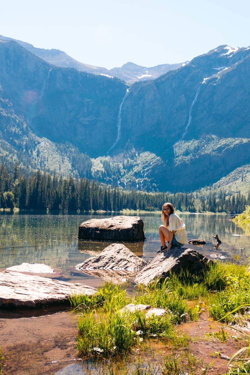
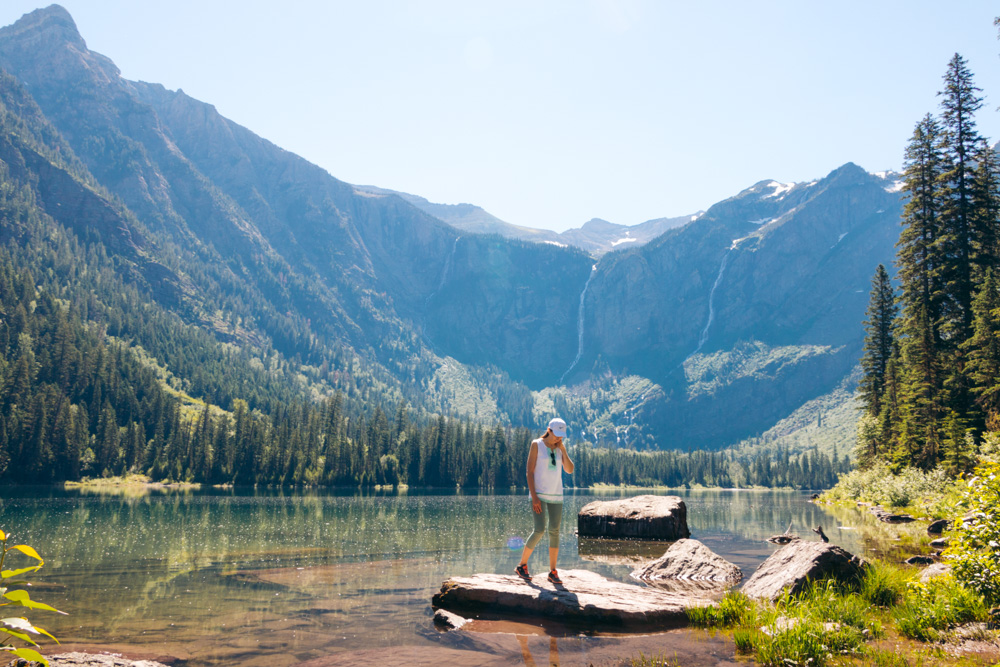
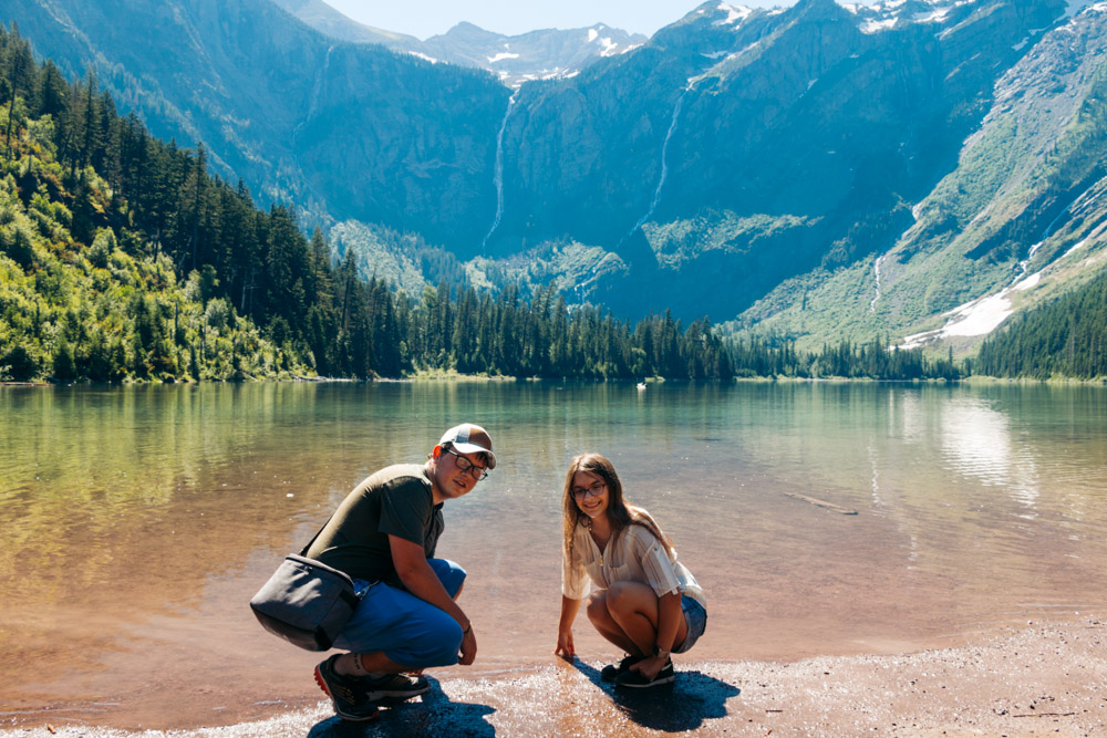
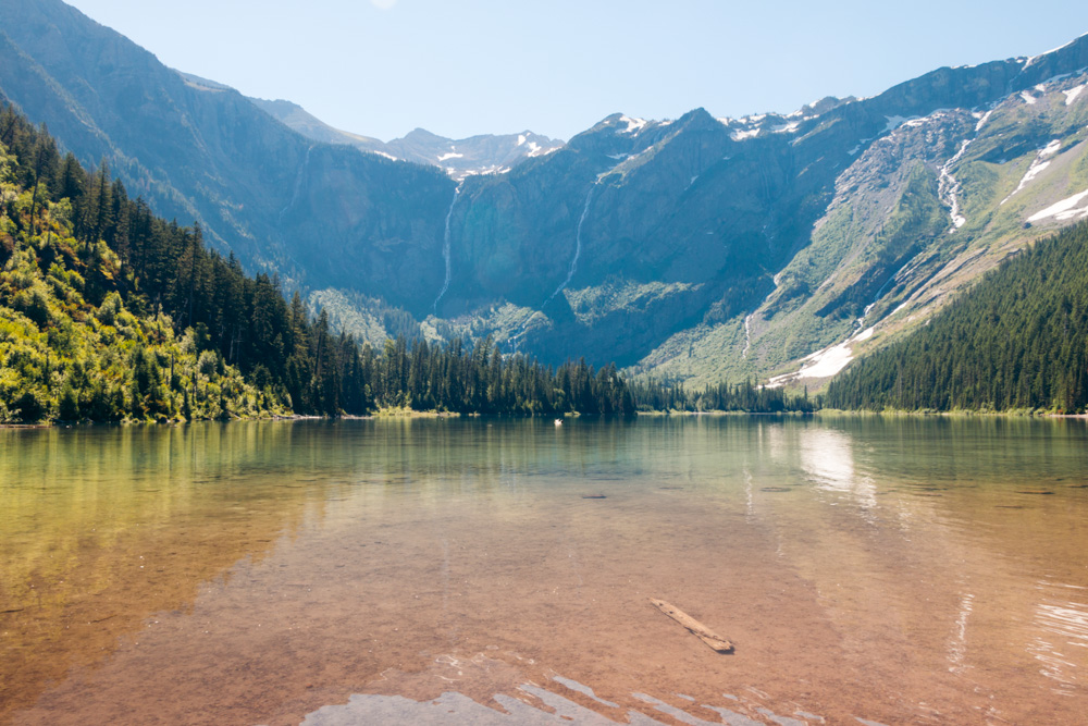
Avalanche Lake at Last
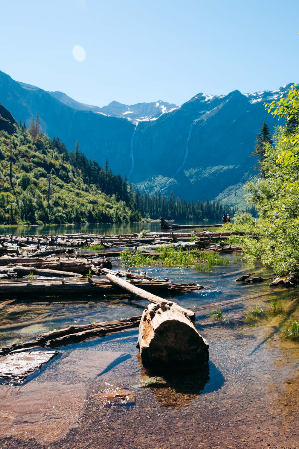
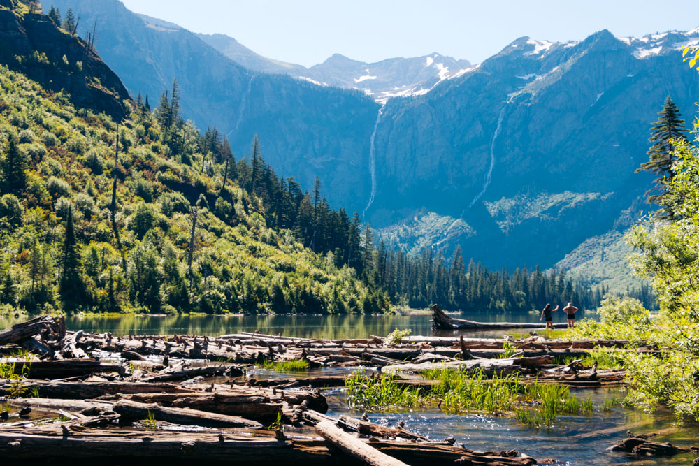
At the last stretch, a short, well-marked path diverges from the Avalanche Lake Trail and takes you directly to the shore. The first stop looks rough, though. The area is filled with fallen tree trunks. These, however, spoil neither the view nor your first impression of Avalanche Lake, but add a raw, pristine vibe to the place.
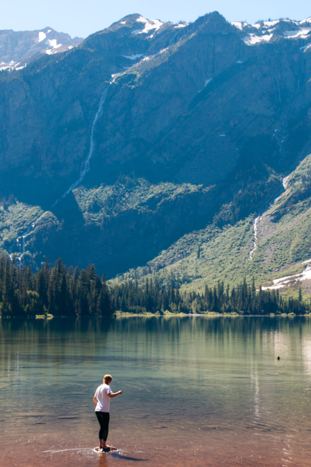
The tree trunks are secondary to the picture that opens up in front of you. Bearhat Mountain with Sperry Glacier on the top comes down the southwestern corner of Avalanche Lake, creating a magnificent guarding curtain. Several Glacier’s waterfalls find this idyllic location irresistible, cascading down the mountainside until they disperse into the lake.
Things to Do at Avalanche Lake
The majority of Glacier’s visitors usually spend several minutes at the first stop of the Avalanche Lake area. A “cleaner” beach is just a few feet away.
1. Swim in Avalanche Lake
Swimming in Glacier National Park is allowed. And although after the 2.5-mile hike, Avalanche Lake looks quite appealing, it’s also freezing cold due to its alpine nature.
2. Fishing
Yet unlike other alpine lakes of similar size, Avalanche Lake provides a sustainable environment for fish. With that said, fishing might be a better activity to do when you complete half of your Avalanche Lake hike.
3. Look for Hidden Coves
A plethora of secluded spots dot the shore of Avalanche Lake. If it’s something that arouses your curiosity, venture off the beaten pass and find one of these hidden coves. Walk down to the water and take in the beauty of the lake, undisturbed by other visitors.
4. Photograph Avalanche Lake
For all photographers out there, slightly prolonging your Avalanche Lake hike rewards you with the most pristine vantage points where it feels like you have the entire area all to yourself.
5. Have a Picnic
Furthermore, you can have a picnic by the lake (be sure to take out all the trash, though) while peering at the surrounding mountains. The luckiest visitors may even spot some wildlife of Glacier, grazing on the mountainside.
The End of the Avalanche Lake Hike
To get back to the trailhead, hike from Avalanche Lake to the Avalanche Lake Trail junction the same way you came from. At the intersection with the Trail of the Cedars, continue on along its western, board-less section. This part of the loop is shorter and leads you to a hollow tree, popularized by Instagram. Here you can also find a restroom.
The Best Time to Hike to Avalanche Lake
Avalanches prevail in this part of Glacier National Park during the colder months. The Going-to-the-Sun Road itself closes 10 miles from the entrance, cutting off easy access to Avalanche Lake trailhead. You can still hike to the lake and enjoy a mesmerizing winter wonderland along with the absence of crowds.
The Avalanche Lake Trail is beautiful and still serene during the shoulder seasons. In late spring or early summer, massive snow packs sliding down the mountainside are a prevailing sight at the end of the hike.
The summer season, mid-June through September, is the favorite time to hike to Avalanche Lake. Dry and free from any snow, the trail is easy to walk. Furthermore, the warm weather contributes to a pleasant hike and clear views of Avalanche Lake.
What to Pack for Avalanche Lake Hike
- Water. Although the Avalanche Lake hike has the advantage of plenty of shade, formed by the tall trees, you can never go wrong with an extra bottle of water to keep yourself hydrated.
- Snack. Replenish your energy halfway through the hike while admiring the views at the shore of Avalanche Lake.
- Sunscreen. Again, your chances of sunburns are minimal due to the forested nature of the Avalanche Lake hike. Yet better be protected than sorry and slather that sunscreen on the exposed areas of your body.
- Hiking staff. Bring them along for additional support while climbing up several hills along the forested section of the Avalanche Lake Trail.
- Bear Spray. Bears roam freely in the forested areas of Glacier National Park. We didn’t encounter any large animals while hiking to Avalanche Lake. Yet they are not rare here. So be sure to have the bear spray and use it only when the animal tries to attack you.
- Camera. Bring your camera or smartphone to capture some special moments and sites while doing the Avalanche Lake hike. Mental images have a tendency to wear out after a while. Hardcopy captures or digital shots will remind you of the Avalanche Lake hike for years to come.
TIP: If you’re interested in other photogenic destinations, check out our guide to the iconic photo spots in Glacier National Park.
Tips for Hiking the Avalanche Lake
Leave No Trace
Don’t feed animals and don’t forget to pack out all the trash after having a picnic at the Trail of the Cedars/Avalanche Lake picnic area.
Avoid Accidents
Rocks and moss near Avalanche Creek and Avalanche Lake can be slippery. Walk carefully and watch your steps to avoid any accidental slips into the water.
Beware of Bears
Hiking alone is discouraged in Glacier National Park due to a high probability of encountering wildlife, including bears. The Avalanche Lake hike is not an exception. So be vigilant, make noise, and try to find a hiking buddy before venturing into the woods.
READ MORE: How to Protect Yourself from Bears in the Wild: Tips and Myths
Arrive Early
Finding a parking space at the Trail of the Cedars/Avalanche Creek area is not a joke. If you plan to walk to either one of these destinations or hike all the way to Avalanche Lake, arrive early to claim one of the parking spots.
TIP: Alternately, you can park at Logan Pass and take a shuttle to the Trail of the Cedars trailhead.
Note: Finding an open spot at Logan Pass doesn’t get any easier. By noon, the parking lot is normally full, and the visitors trying to get to the area are turned away.
Don’t Bring Pets on the Avalanche Lake Hike
You can’t hike to Avalanche Lake with your pets. Pets are not allowed on the hiking trails in the park. The majority of other hiking trails in Glacier National Park also comply with the same rule.
Places to Hike to Near Avalanche Lake
1. Avalanche Campground. The campsites are located across the road from the Trail of the Cedars.
2. Lake McDonald Lodge. The Lake McDonald Lodge is located 5.5 miles west of the Trail of the Cedars/Avalanche Lake Trail.
3. Logan Pass. The highest point along the Going-to-the-Sun Road, Logan Pass is 15.9 miles (36-minute drive) east of the Trail of the Cedars/Avalanche Lake hike.
4. McDonald Falls. McDonald Falls is a 4.1-mile hike or 9-minute drive from the Trail of the Cedars/Avalanche Lake Trail.
