And so we went on a hike along the Soberanes Point, Whale Peak Trail – we learned its name later – where spring wildflowers still abounded, transforming Garrapata State Park and instantly making it one of our favorite areas in Big Sur.
A Complete Guide to Hiking Soberanes Point, Whale Peak Trail in Garrapata State Park in Spring
With no official signs along the northern section of scenic Highway 1, we relied only on offline map to get to Garrapata State Park. Up to that point, all we knew about the area was that in spring it turned into a floral sea that stretched all the way to the ocean, aiming to merge its colorful, gentle “waves” with fearsome surf.
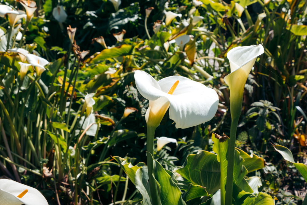
The hidden Calla Lily Valley drew us to Garrapata State Park in the first place. But since we decided to stray away from the main Big Sur road and dive deeper into its panoramic terrain this time around, the Soberanes Point Trail landed on our hiking itinerary almost at the last moment.
To hike the Soberanes Point Trail abundantly festooned by the spring wildflowers asked for little to no effort. Finding the path in an unmarked state park in the Big Sur area, California, turned out to be a slightly bigger challenge.
HOW TO HIKE SOBERANES POINT, WHALE PEAK TRAIL IN GARRAPATA STATE PARK, CALIFORNIA
Soberanes Point Trail Facts
- Distance: 2-mile loop
- Elevation Gain: Approximately 300 feet
- Difficulty: Easy
- Time: 50-60 minutes
Along the Spring-Infused Soberanes Point Trail
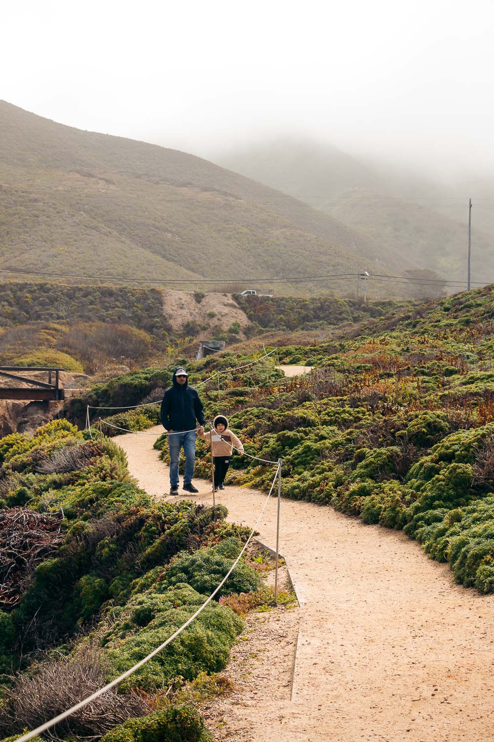
If you look for any signs marking the start of the trail… Oh well, you won’t find them. Garrapata State Park, one of several state parks that comprise the Big Sur area, prefers to remain incognito. Apart from the “Coastal Trail” signs, you hardly see any other road markers.
The same fate follows the 2-mile Soberanes Point, Whale Peak Trail. Running along the coastline, the scenic path lacks a well-defined trailhead. You can rely on an offline map or a hardcopy map to locate the Soberanes Point Trail. Otherwise, keep your eyes peeled for gates 8,9, or 10 with direct accesses to the trail.
On the bright side, the elusive Soberanes Point Trail sits along Highway 1 with copious pull-offs right in front of or near the trailhead. Claim your spot and venture into the spring-infused realm with impeccable views that open up for the lucky hikers from the Soberanes Point, Whale Peak Trail.
The Hike
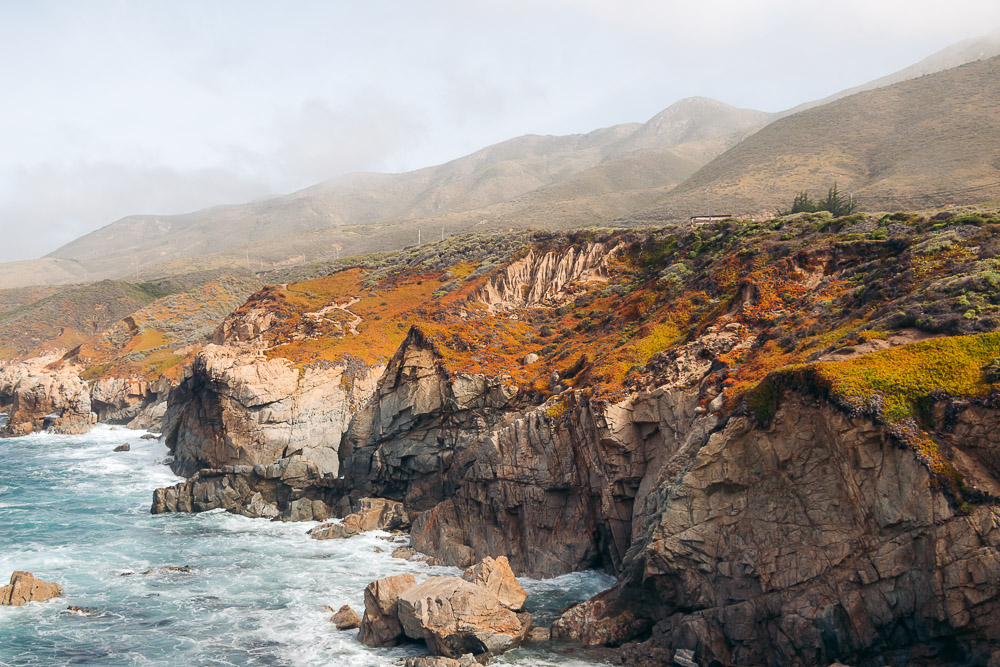
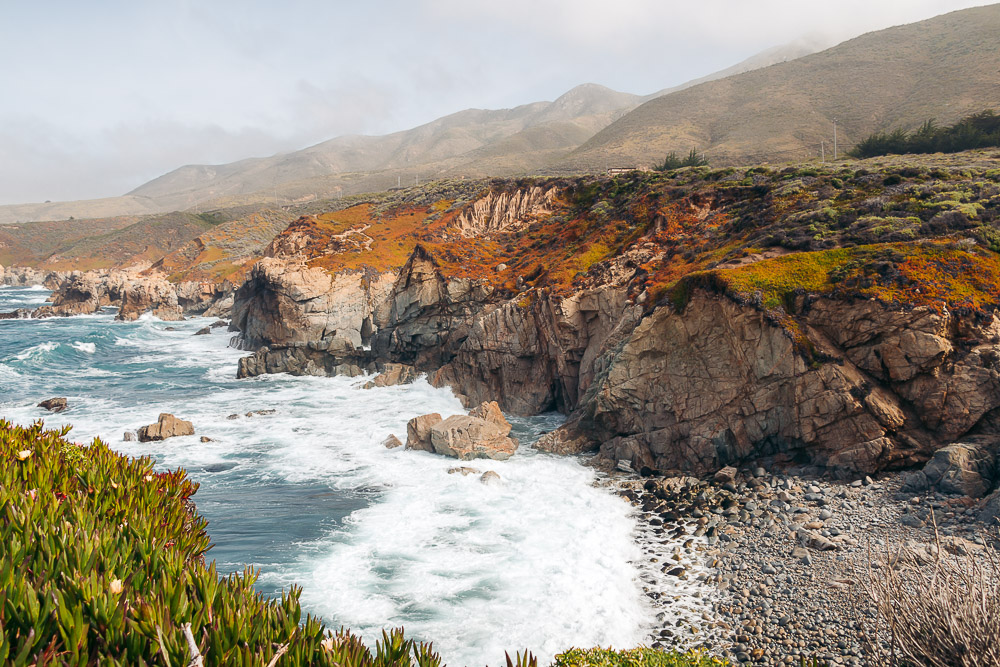
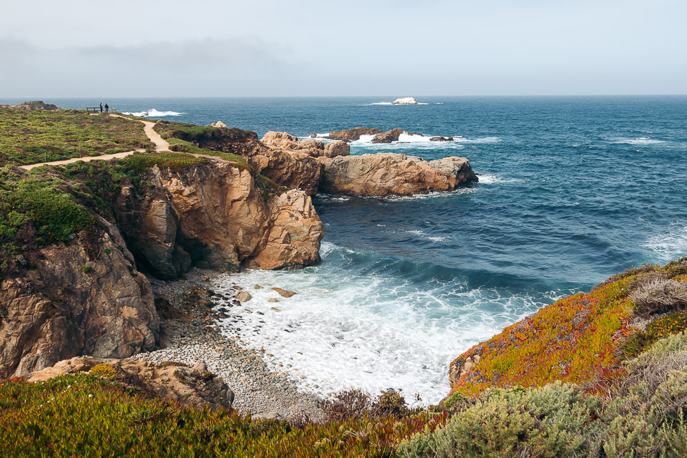
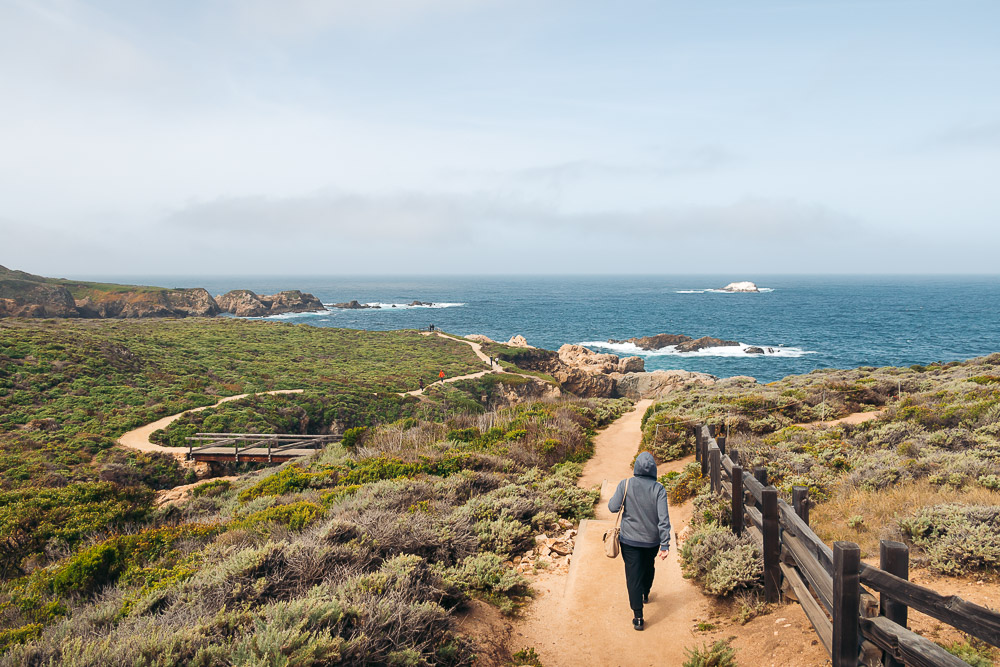
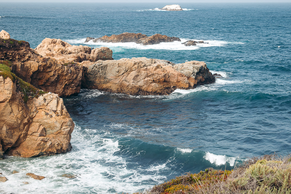
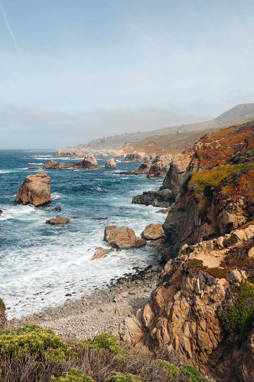
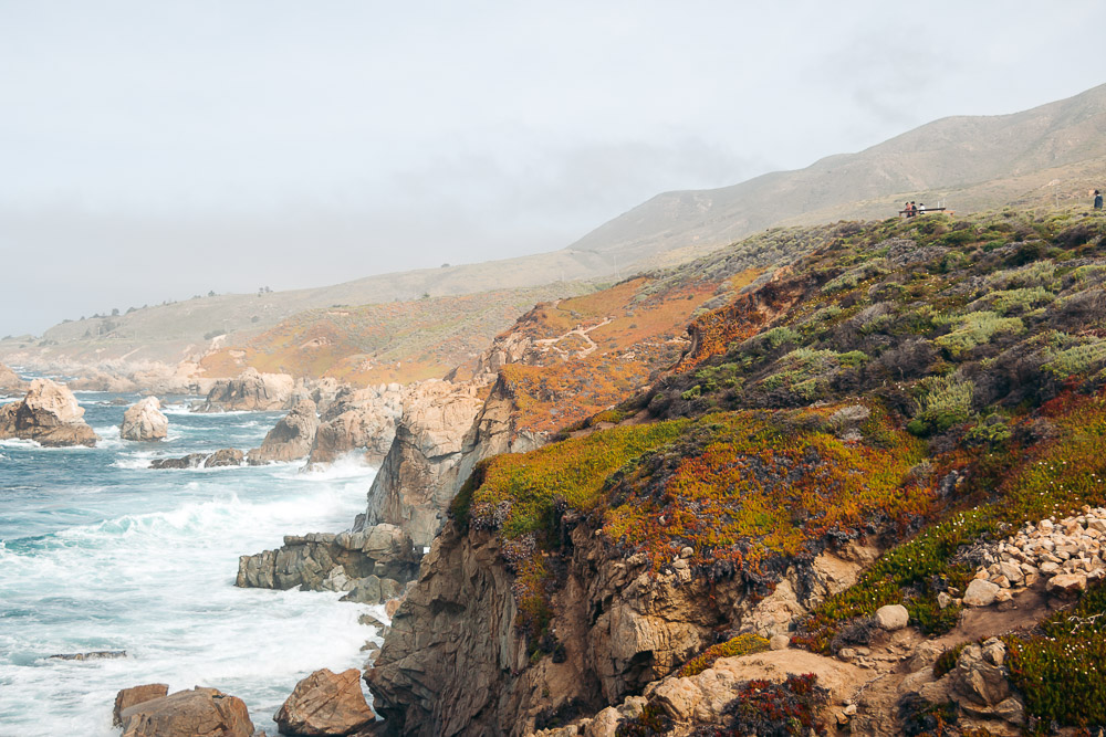
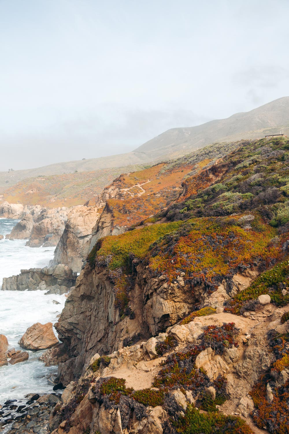
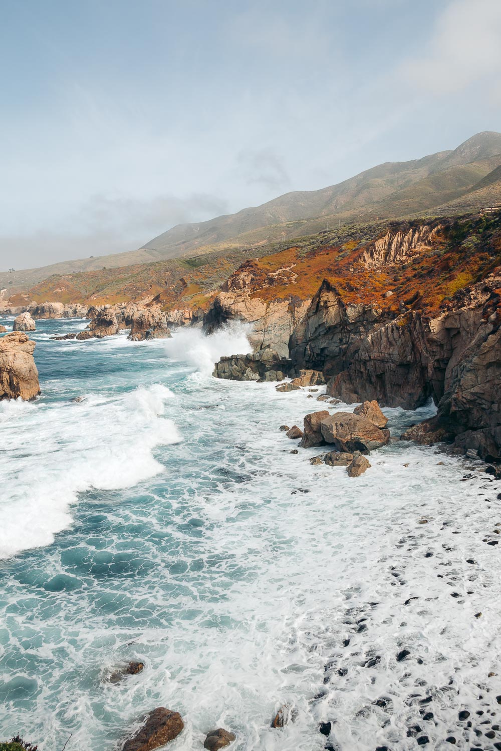
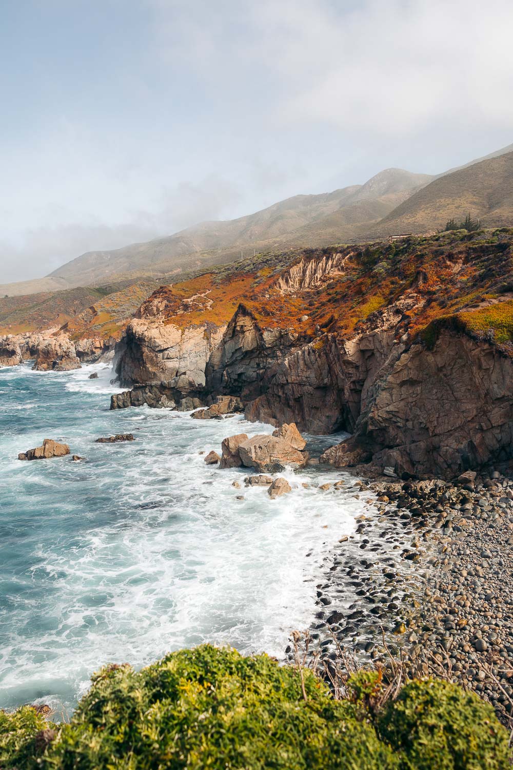
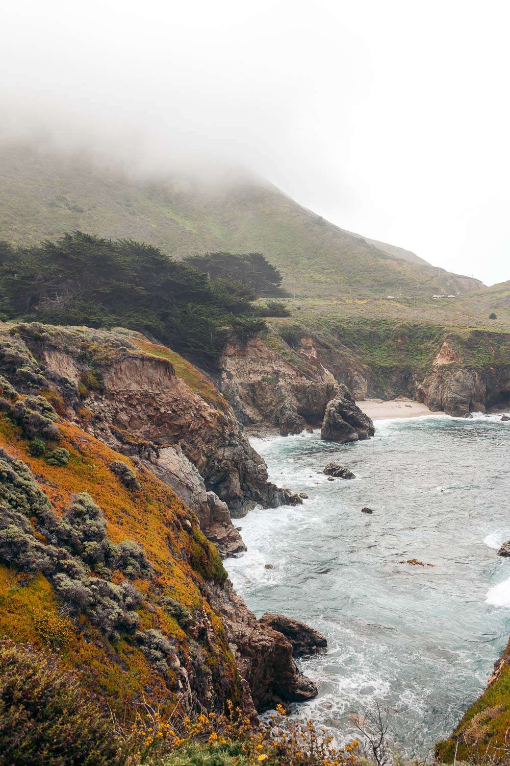
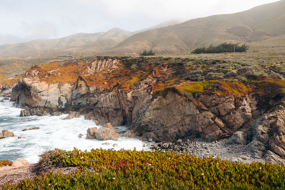
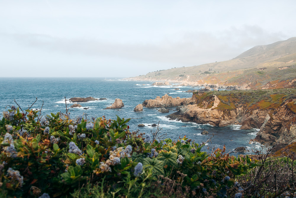
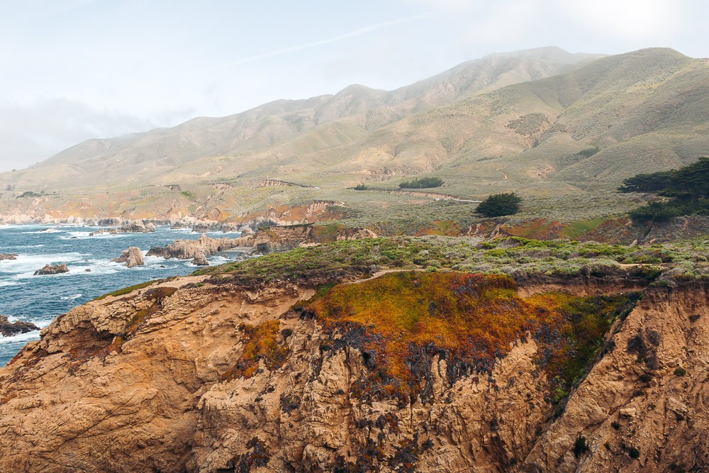
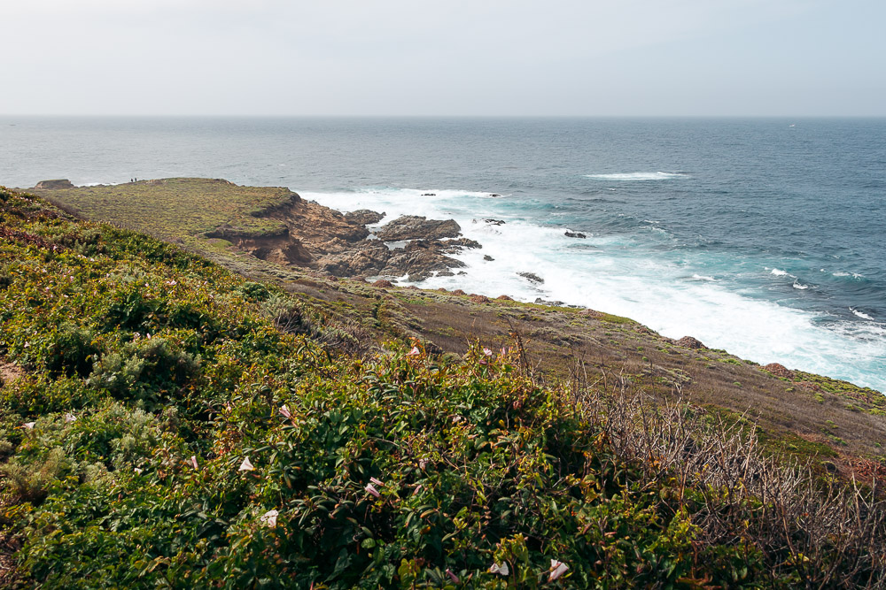
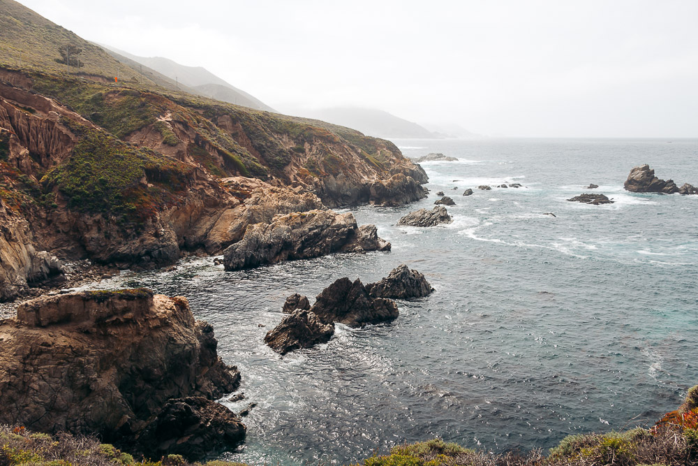
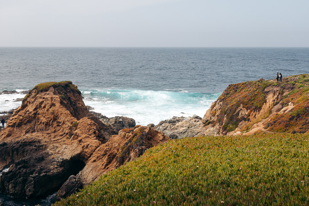
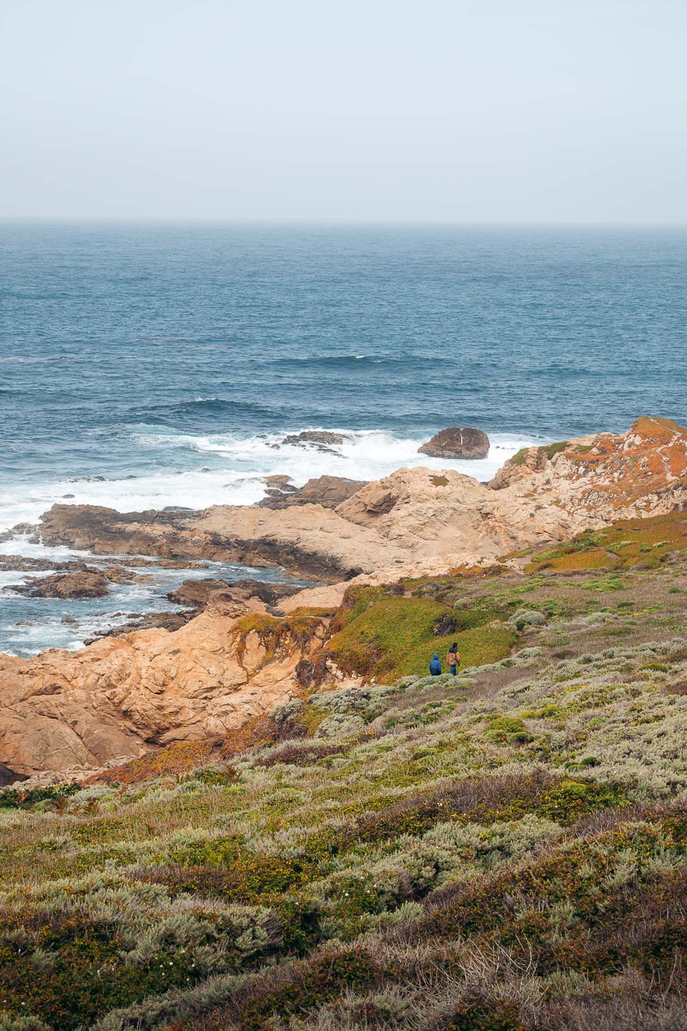
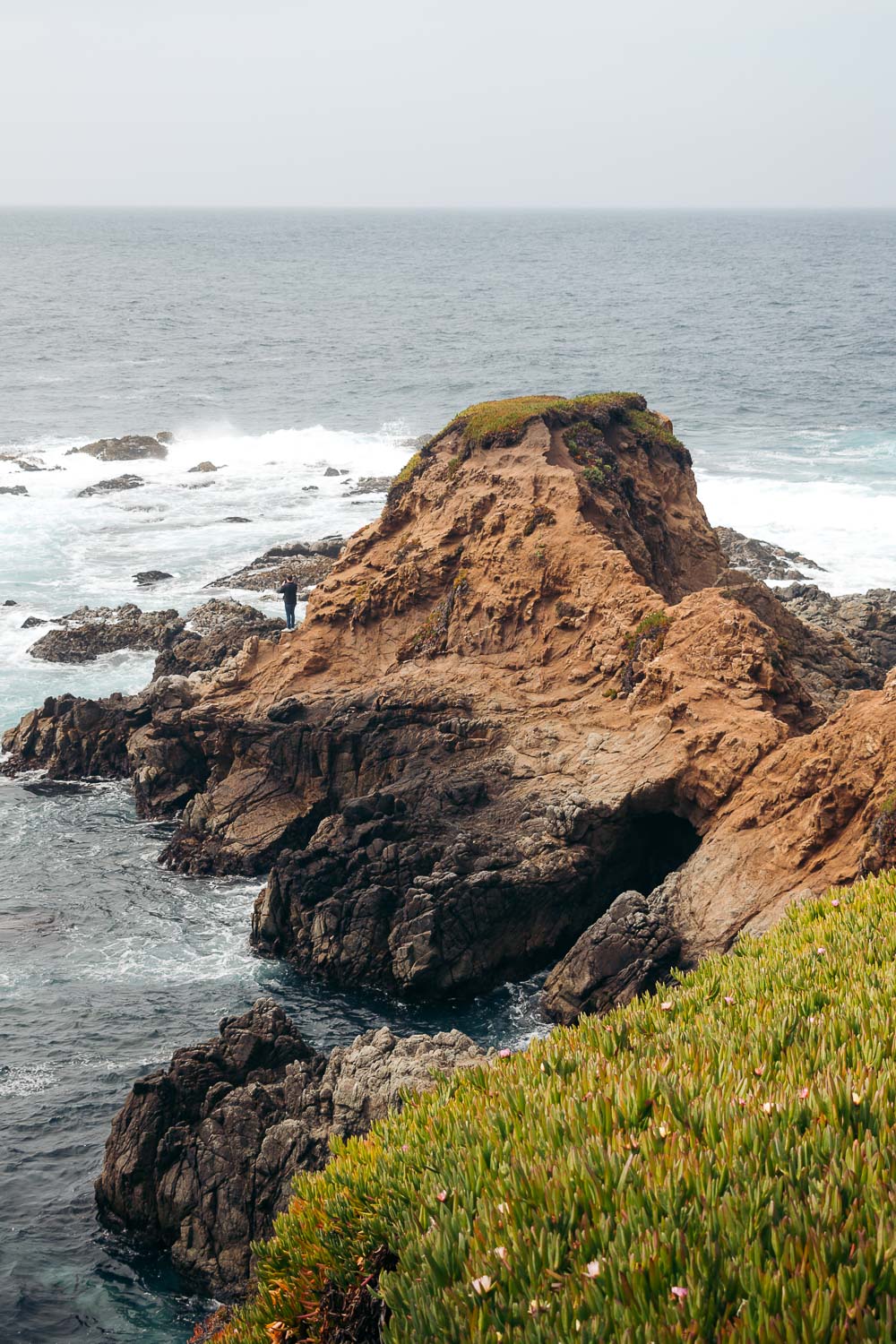
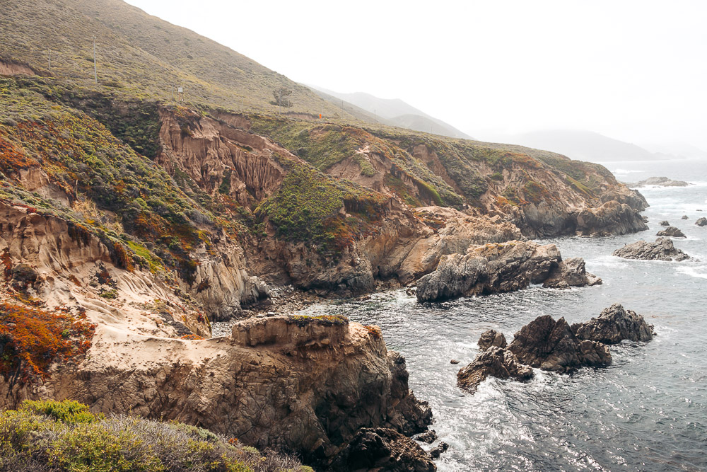
The hike starts as a series of stairs. As you descend, bluffs rise up higher, showcasing the spring brilliance on the opposite side of the cliff. The views become even more spectacular. You don’t feel like a mere observer, but rather an essential piece of the surroundings at this point.
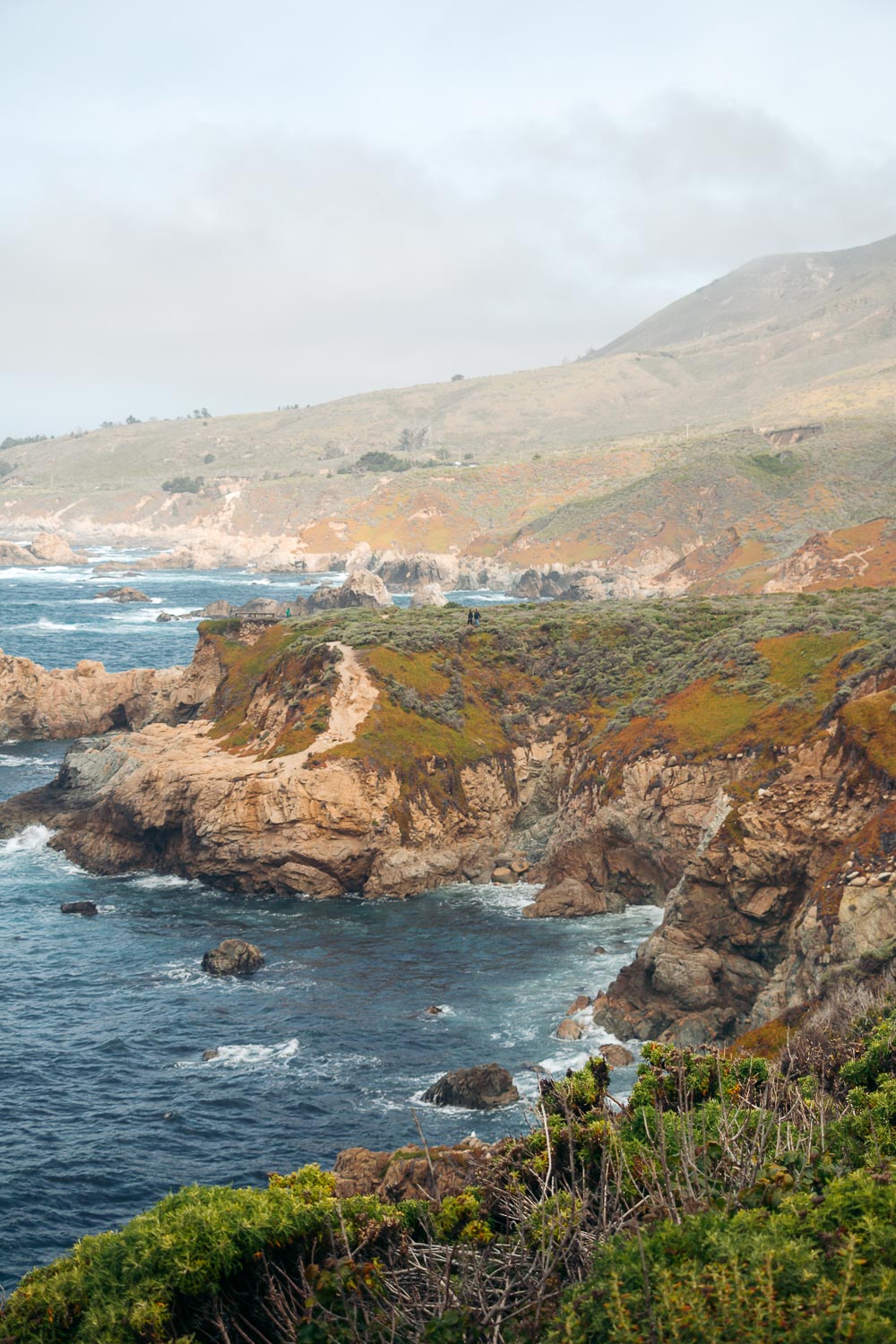
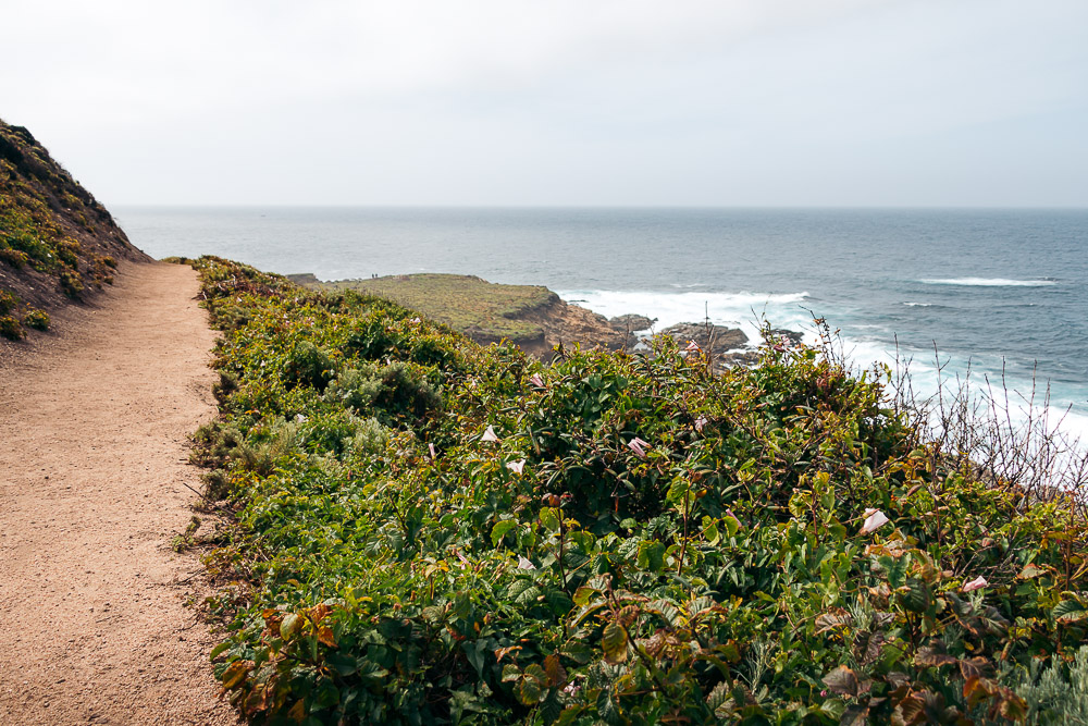
A few observation decks align the Soberanes Point Trail. If you feel like 2 miles is too much of a hike for you, you can linger at this section of the Soberanes Point Trail a little bit longer before returning to the car.
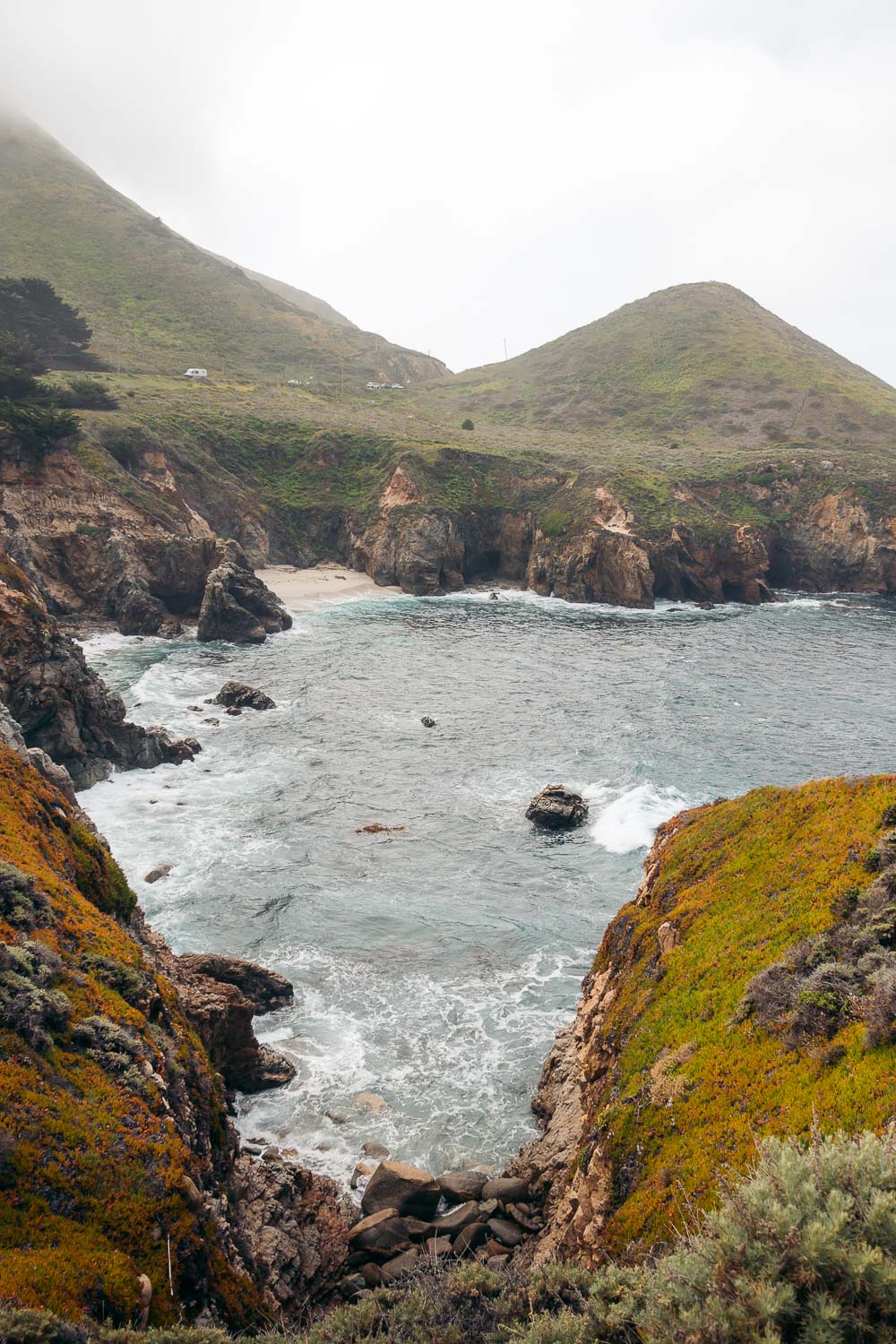
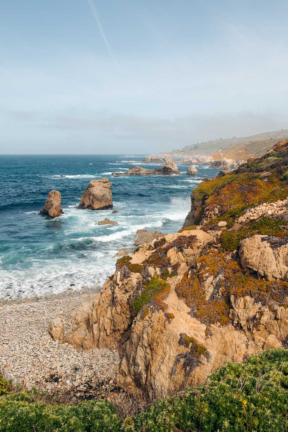
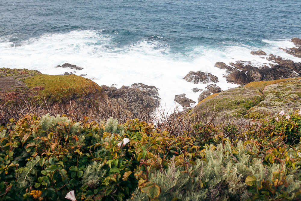
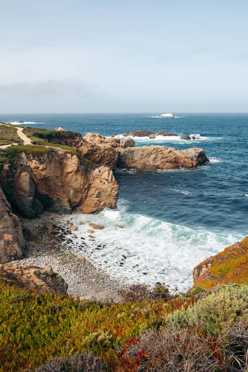
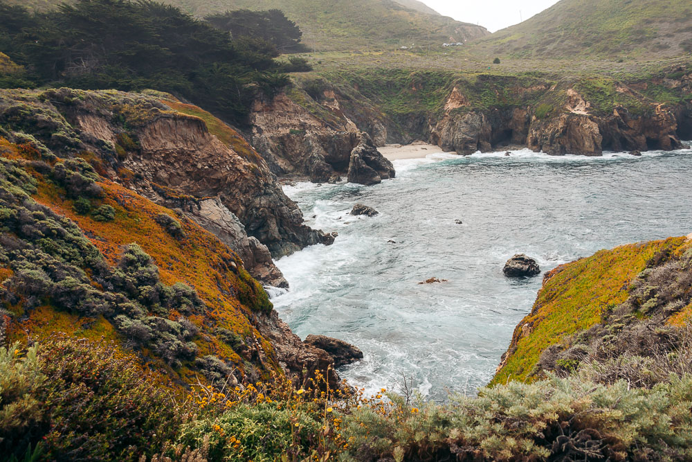
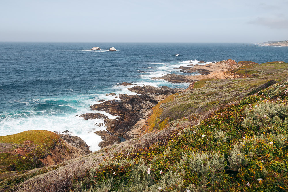
Those who decide to hike farther up, normally lose the crowd beyond this point. The Soberanes Point Trail that snakes around Whale Peak and eventually takes the hiker to Soberanes Point remains relatively flat from now on. A few narrower trails branch off from the main path, taking its guests down to Garrapata Beach.
The Soberanes Point Trail starts changing elevation toward the end of the loop. A few staircases loom along Highway 1 once again. If you follow the path, you’ll get back to the same trailhead you started the hike at.
Alternately, you can hike on the side of the highway until you get back to the car. This route, however, may be inconvenient, especially in those areas where hills come close to the road without leaving any spaces for the pull-offs.
Things to Know before Hiking Soberanes Point Trail
Entrance
Unlike some other state parks in the Big Sur area, Garrapata State Park is a free area. There is not entrance fee to hike the Soberanes Point Trail and enjoy the spring bloom along the way. Yet as we mentioned before, no clearly marked signs pamper the hikers here, making it extremely easy to miss the entire area, including the Soberanes Point, Whale Peak Trail.
How to Find Soberanes Point, Whale Peak Trail
The only directions in the park are marked turnout gates, numbered from 2 to 19. The Soberanes Point Trail accesses are located at gates 8, 9, and 10.
Parking
The parking situation is easier in Garrapata State Park compared to some ofter parks in Big Sur. The lack of the clearly marked signage makes the travelers pass though without realizing all the splendor the park is willing to bestow on them.
Consequently, the area never sees as many crowds as the nearby Point Lobos State Natural Reserve. As a result, you rarely encounter any problems with parking, which is mostly presented by the pull-off areas.
The Best Time to Hike Soberanes Point Trail
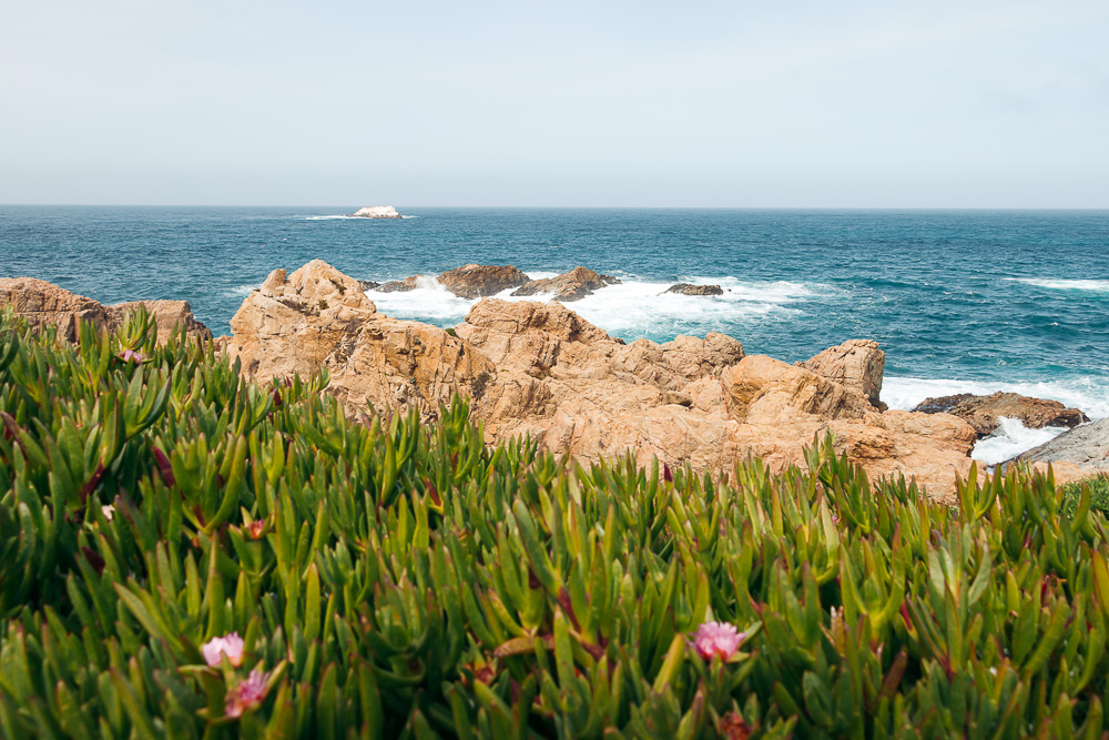
The scenic Soberanes Point Trail is open for hikes and walks all year round. The spring bloom, however, adds extra vibrancy to the surreal surroundings. Thousands of purple, white, yellow, and lilac flowers pop up along the coast from as early as mid-February though April.
In some areas, the California bloom stays intact until mid-May. So if you look for the vivid spring colors while hiking the Soberanes Point Trail, plan your trip around this time and enjoy California you haven’t probably seen yet.
READ MORE: Where to Find the Best Blooming Almond Orchards in California & Where to See Wildflowers in and near Los Angeles
Restrooms
Despite its rather withdrawn nature, Garrapata State Park offers some basic amenities. A few portable restrooms are located between gates 8,9, and 10.
Places to Visit near Soberanes Point Trail
Point Lobos State Natural Reserve
This paid area sits 5 miles north of Garrapata State Park. Much busier, it allures most of the hikers with its picturesque China Cove along the Bird Island Trail.
Calla Lily Valley
Located within Garrapata State Park, the Calla Lily Valley sees an influx of the visitors from mid-February through April when wild calla lilies bloom. The area nestles 2.2 miles south of the Soberanes Point, Whale Peak Trail.
Bixby Creek Bridge
The iconic Bixby Creek Bridge is only 6.2 miles south of the Soberanes Point, Whale Peak Trail. Being a part of Highway 1, the structure doesn’t require hiking to showcase itself in its full glory. If you wish to take a few pictures of this signature landmark, stop at any overlooks near the either side of the bridge.
Places to Explore near Soberanes Point, Whale Peak Trail: Map
A Complete Guide to Hiking Soberanes Point, Whale Peak Trail in Spring: Photo Diary
Read Next
- How to Visit McWay Falls, Big Sur (+Tips and Photos to Inspire You)
- 11 Reasons to Visit San Simeon, California: The Best Things to Do and Places to See
- Big Sur Photo Diary
- The 7 Most Photographed Places in Big Sur, CA
