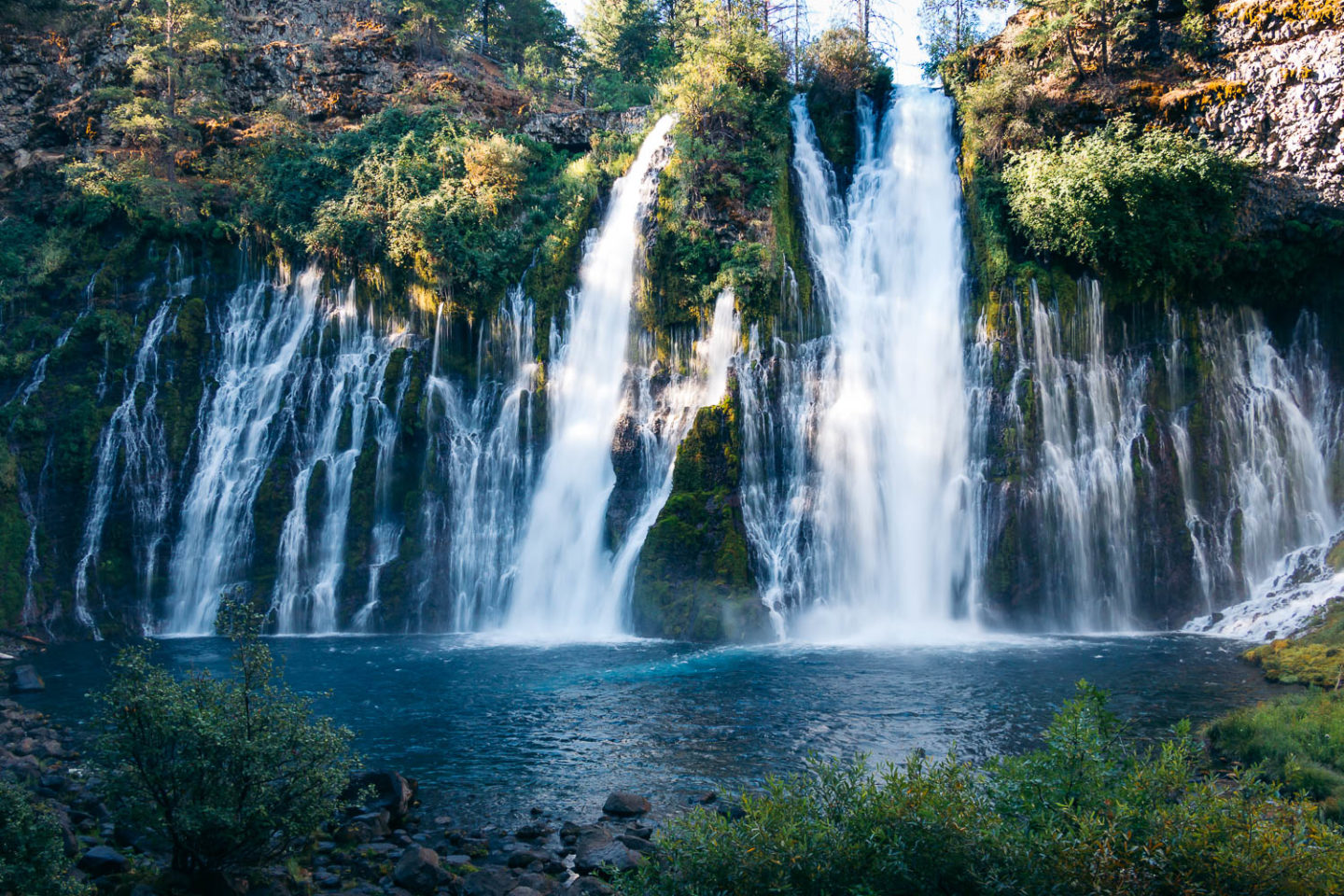
Not the highest or largest waterfall, Burney Falls is still one of the most sought-after destinations to visit in Northern California.
A Complete Guide to Visiting Burney Falls: Burney Falls Loop Trail Hike and Photographic Journey
Burney Falls has been on my radar for ages. Normally not a person who plans her travels based on places portrayed in social media, I became quite curious about the falls after stumbling upon an image of it on Instagram. Waterfalls in California normally dry out during hot summer days. But not Burney Falls. It flows forcefully throughout the year, creating a thick mist around it.
I hoped to visit Burney Falls during our spring road trip through Central California. But the drive from Pinnacles National Park to McArthur-Burney Falls Memorial State Park was way too long. So we had to skip it.
A new opportunity to visit Burney Falls arrived when we went for the second round of dramatic waterfalls in Oregon during the last days of August. And to make absolutely sure that we wouldn’t miss the popular natural attraction in Northern California this time around, we headed to the area on a weekday, the least popular time to visit McArthur-Burney Falls Memorial State Park.
Visit McArthur-Burney Falls Memorial State Park: Location and Attractions
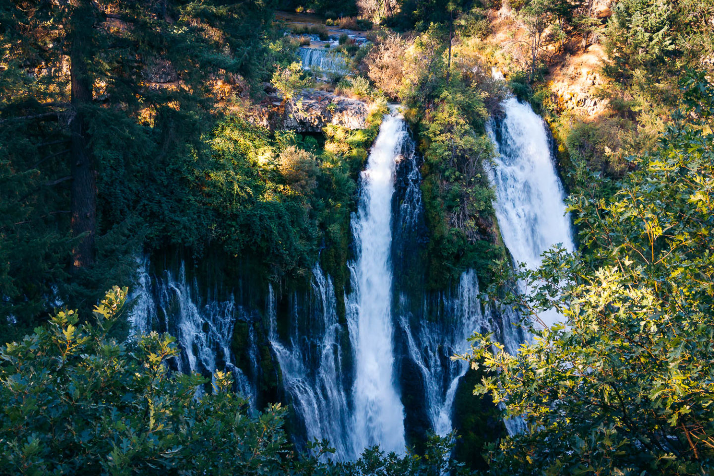
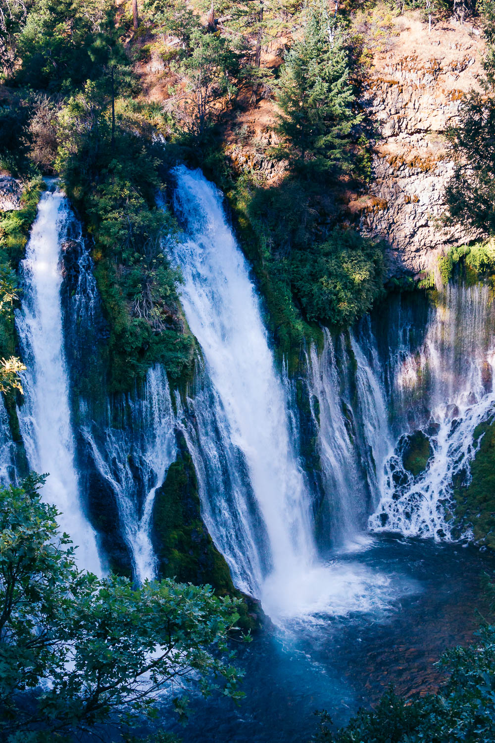
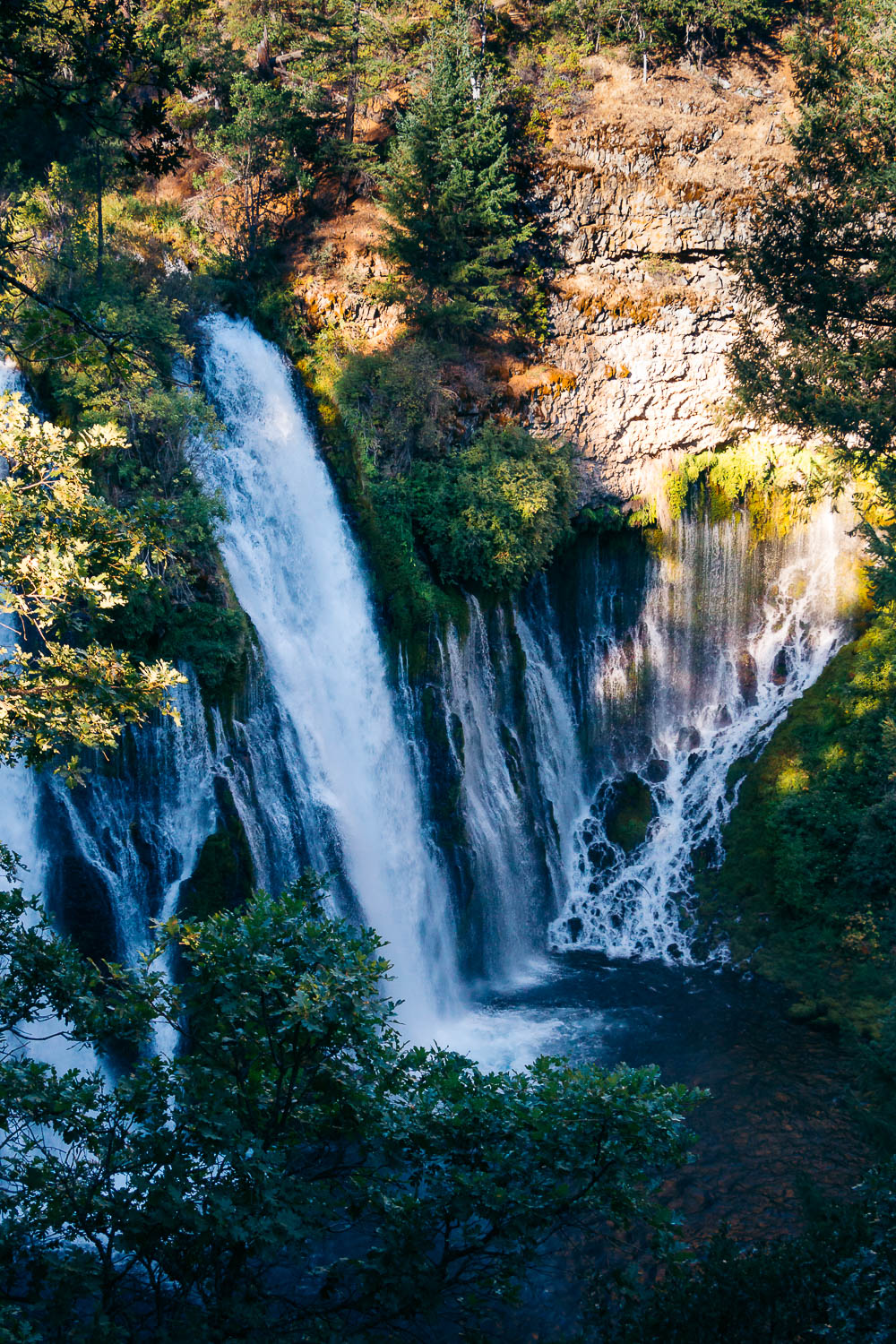
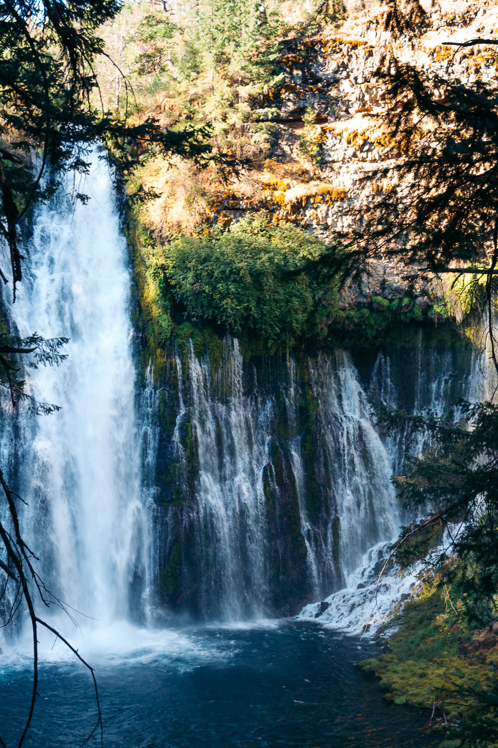
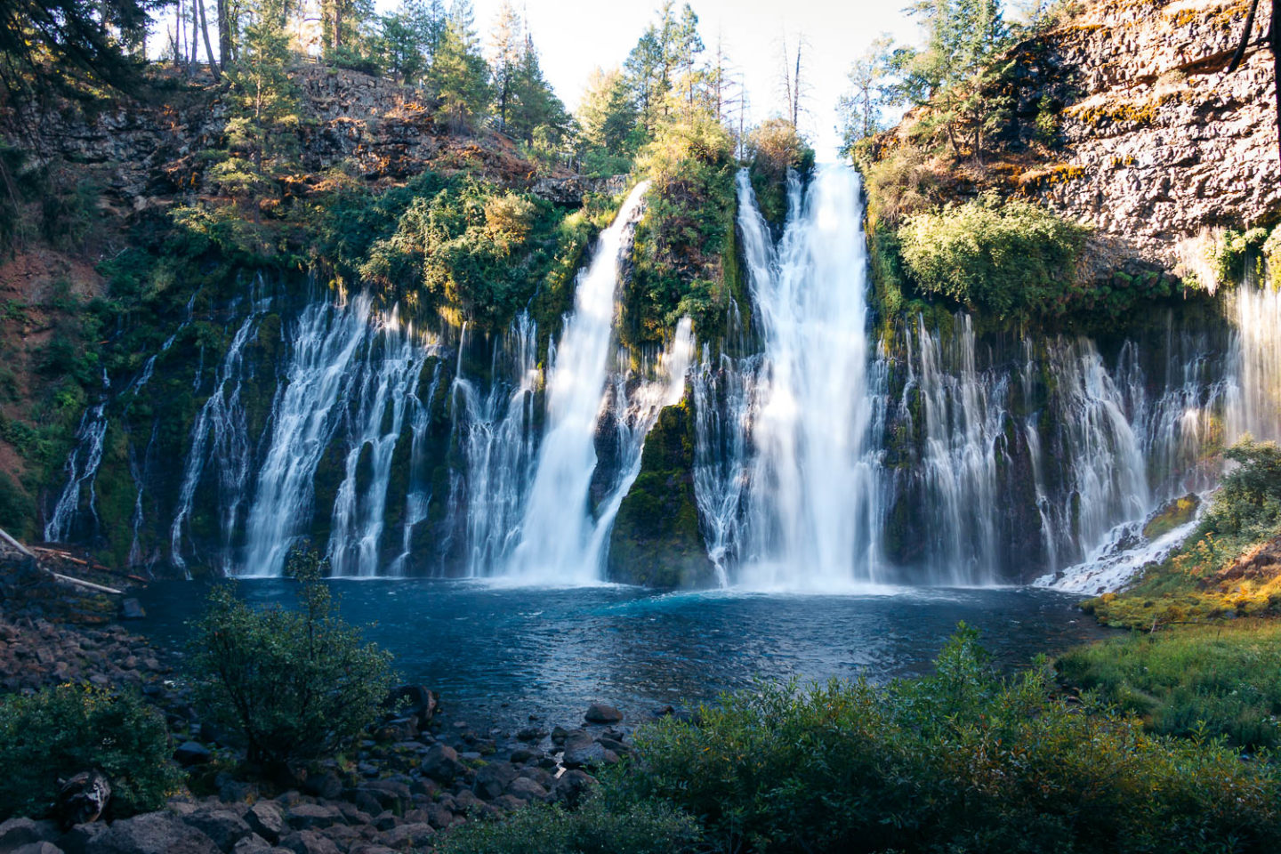
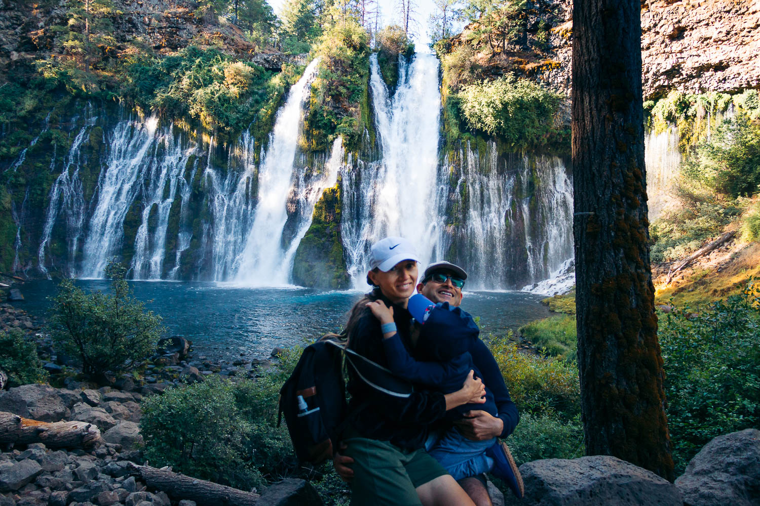
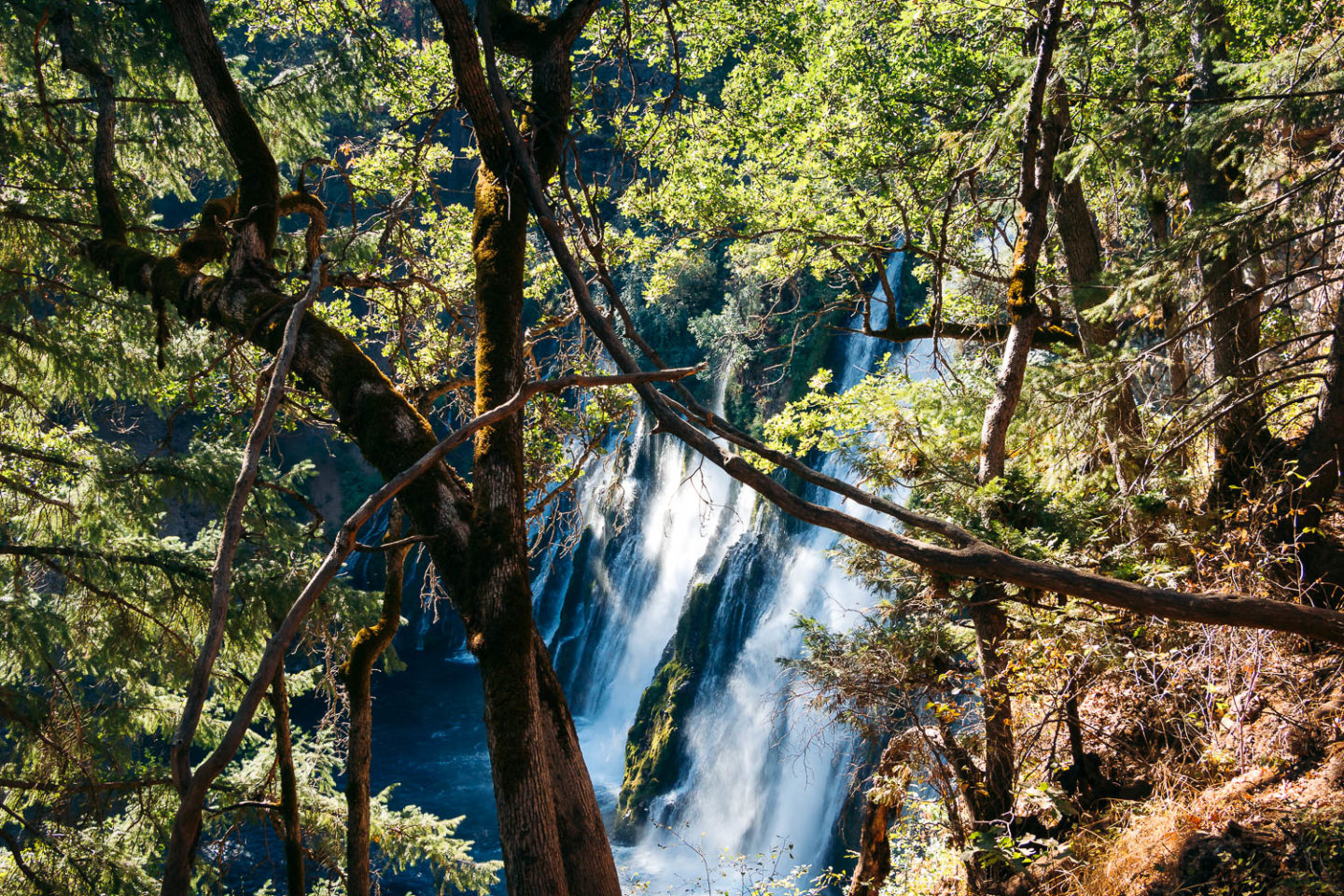
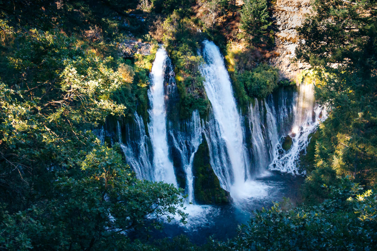
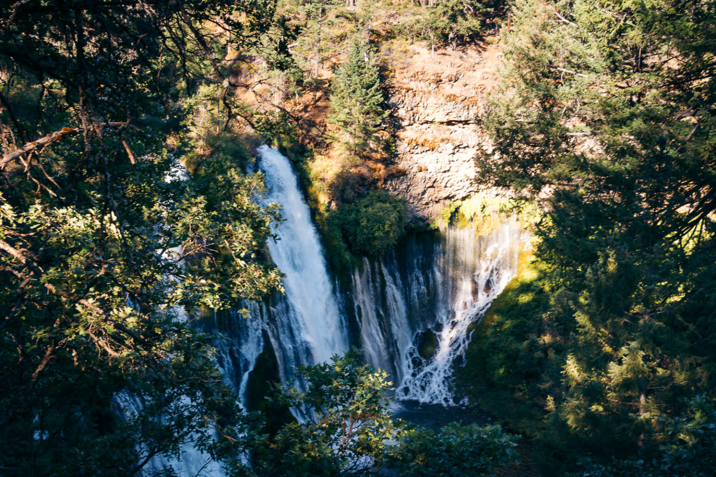
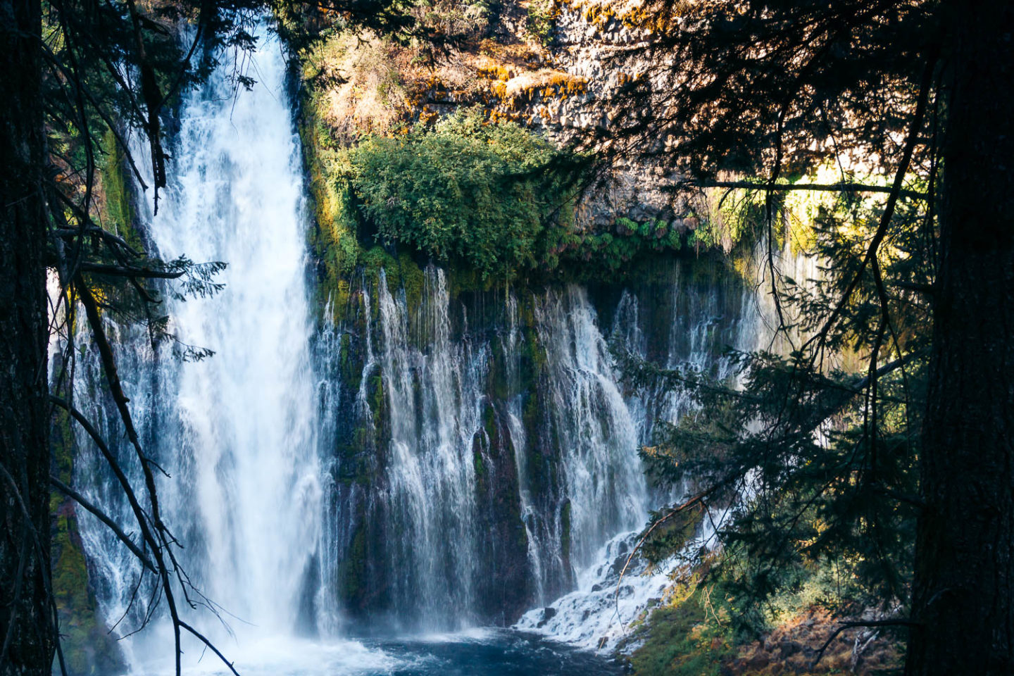
Burney Falls is a 129-foot waterfall on Burney Creek. While the site is the main landmark that allures hundreds of thousands of visitors yearly, it’s not the only attraction within McArthur-Burney Falls Memorial State Park. The 565-acre area boasts several scenic trails; Lake Britton, nestled to the north via the Rim Trail; and a section of the world-famous Pacific Crest Trail.
Surrounded by California’s mountain peaks, McArthur-Burney Falls Memorial State Park resides in a volcanic region in Shasta County.
History in a Nutshell
McArthur-Burney Falls Memorial State Park is one of the oldest parks in the State Park system. Its history dates back to May 1920. Even before being designated a National Natural Landmark (it happened in 1984), Burney Falls had stolen hearts of its earliest visitors. One of them was Scott McArthur.
Fearing that the natural attraction of such beauty could become another victim of hydroelectric development project, McArthur bought the 160 acres of land surrounding Burney Falls. Later he transferred the property to his brother and sister-in-law, Frank and Ethel McArthur.
In May 1920, the couple gifted the land to the State of California in memory of their parents, John and Catherine McArthur. The state paid a nominal price, $1. No further actions to save or preserve the land were done for the next two years.
Finally, in 1922 the property was transferred to the Division of Forestry. Two years later, a fire burned through the area, causing substantial damage to the wild resources. This got attention of the state government. A local John ‘Jack’ Allen was assigned to manage the park that initially was named McArthur Memorial Park.
“Burney Falls” was added to the park’s name much later. The waterfall was named after Samuel Burney, a pioneer settler who lived in the area in the 1850s.
It’s believed that even President Theodore Roosevelt couldn’t dismiss the natural magnetism of the waterfall and called it the “Eighth Wonder of the World”.
How to Visit Burney Falls: Burney Falls Loop Trail Hike
Hike Stats
- Distance: 1.2-mile loop trail
- Elevation: 3,281 feet
- Difficulty: Easy
- Time: 30-60 minutes
The Loop
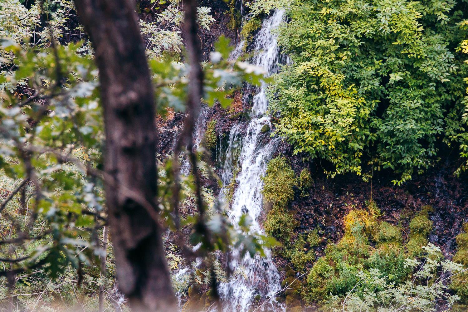
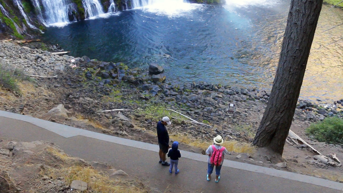
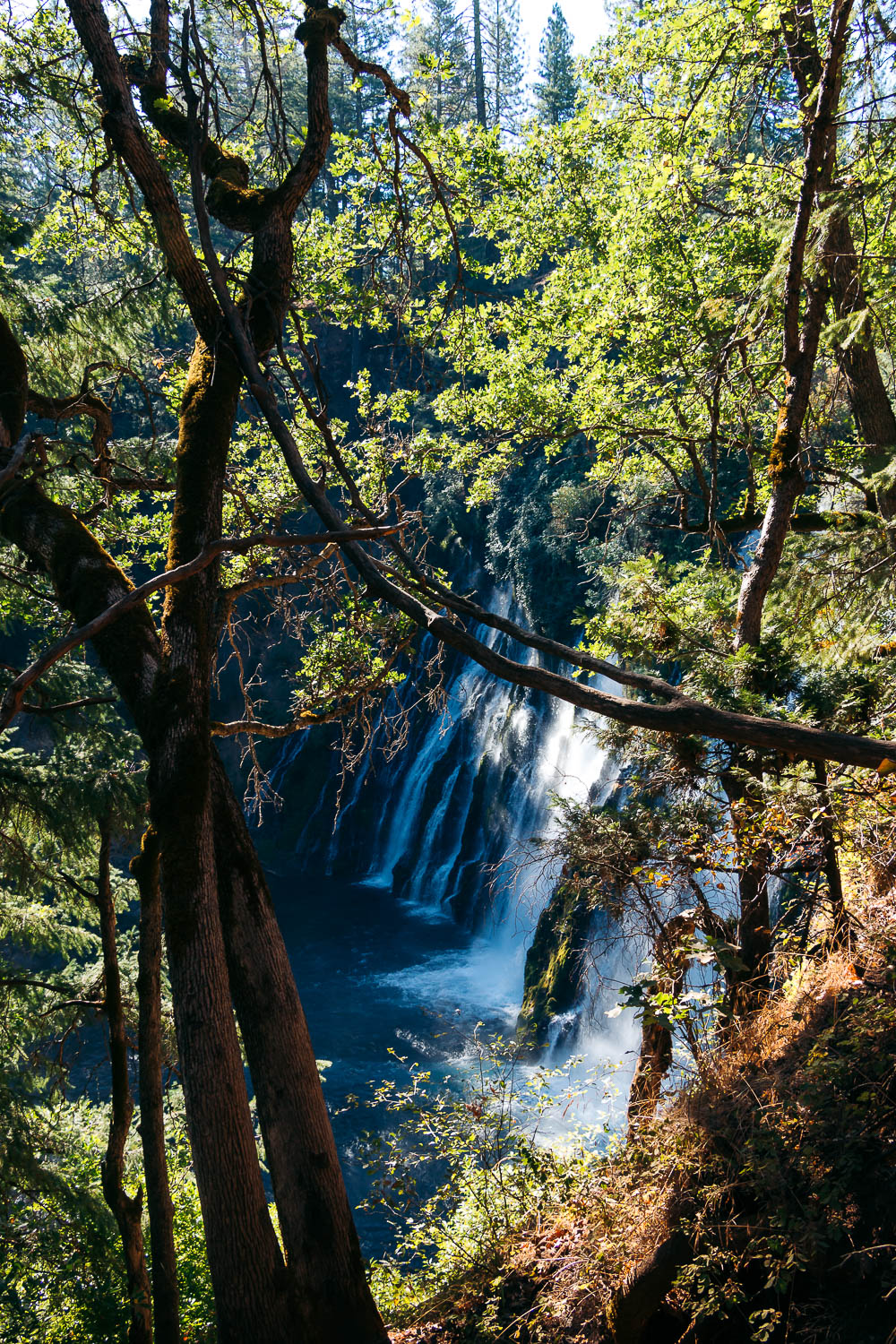
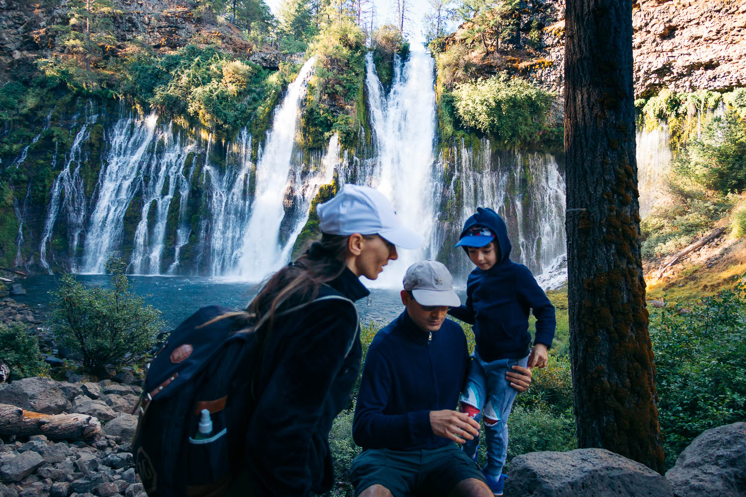
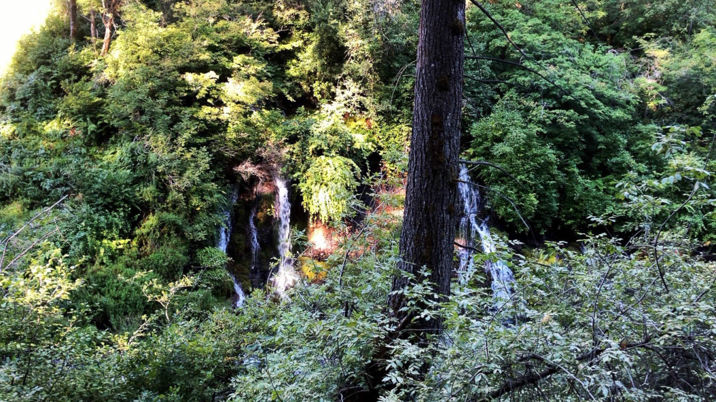
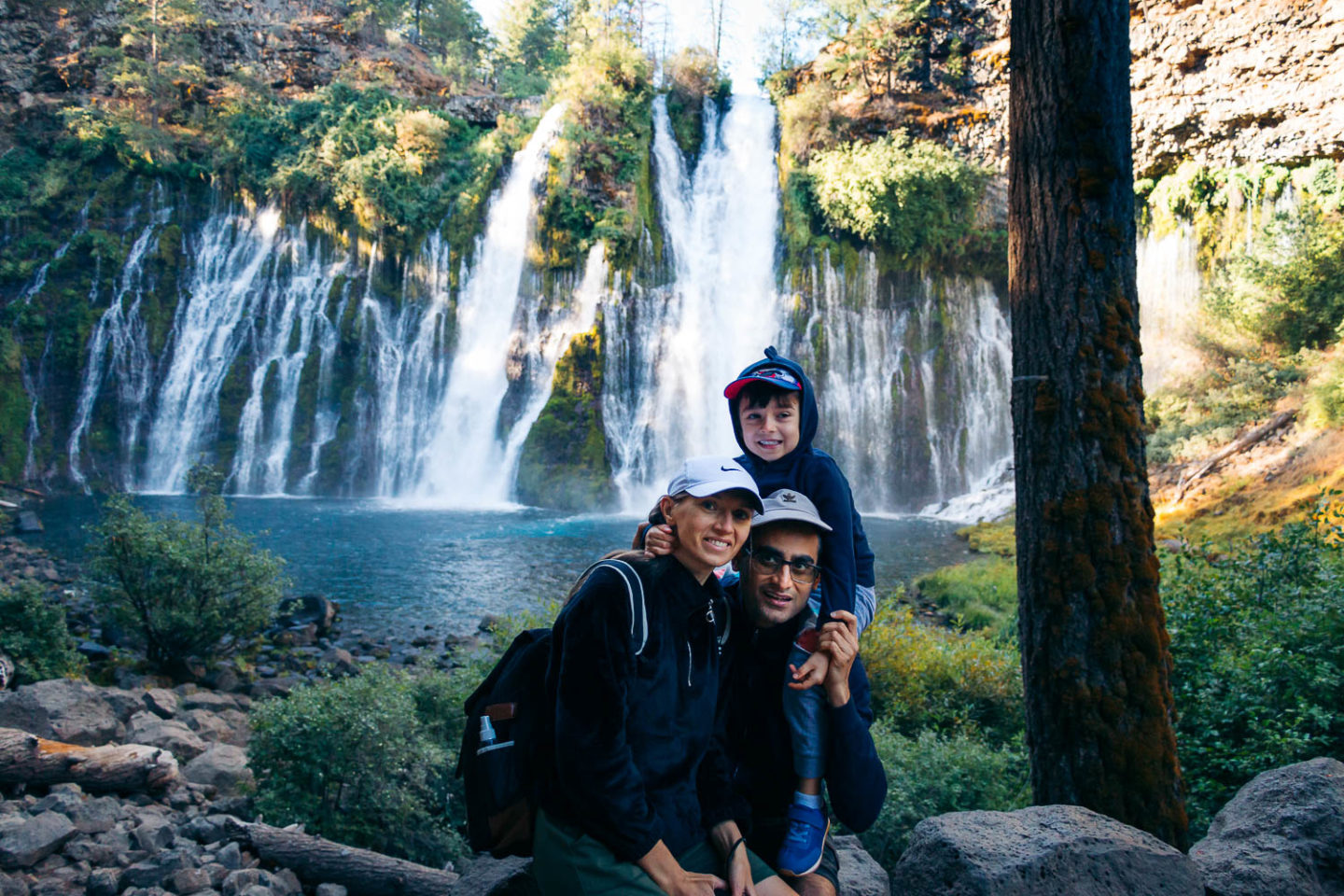
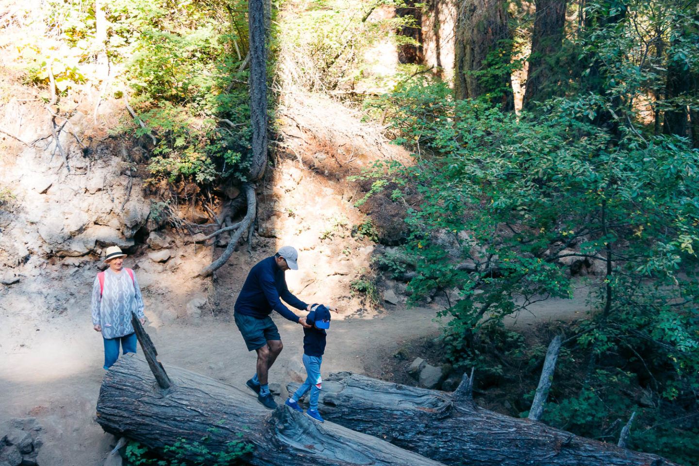
The 1.2-mile trail starts near the parking lot and loops the surrounding area, offering different views of Burney Falls. The hike is easy. From the trailhead, the well-trodden trail descends gradually until it reaches the bottom of the waterfall. The path is only 0.3 mile. It stops right in front of the gushing waterfall, cascading down the 129-foot cliff into a 22-foot-deep pool.
This vantage point is the most popular destination along the trail. Most hikers don’t wander beyond this point. And professional photographers are often the first visitors to access the spot and set up their tripods, ready to capture the gushing site at its prime time.
The reliable flow of Burney Falls is one of the reasons nearly 200,000 travelers visit the waterfall yearly. (This number of visitors reached its maximum in 2020 when a pandemic turned the world upside down, forcing people to look for entertainment in the great outdoors.)
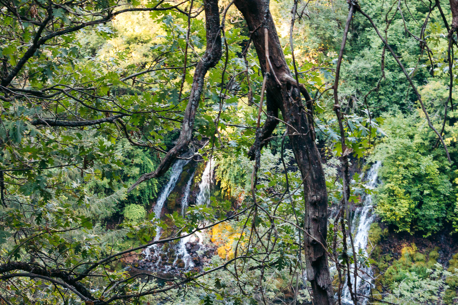
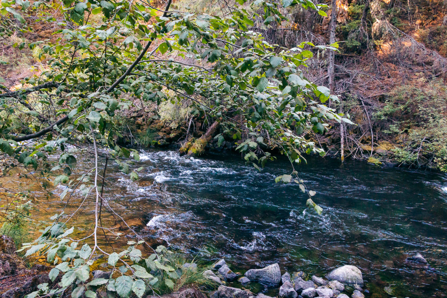
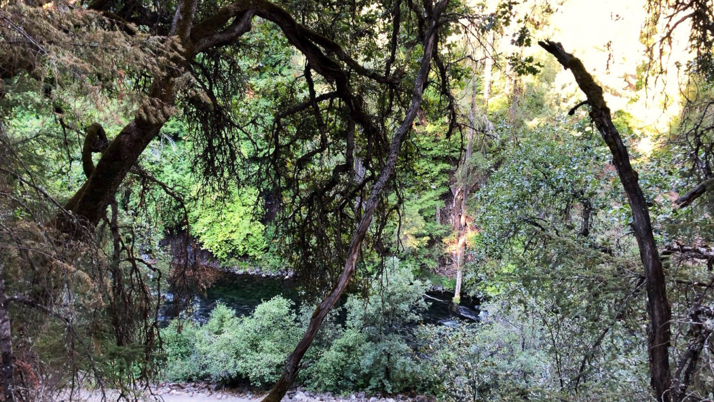
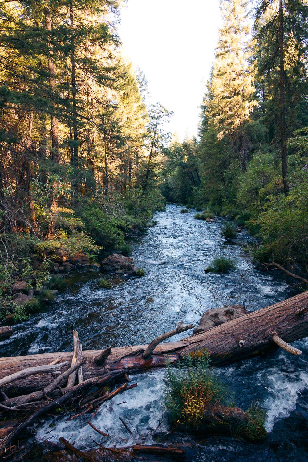
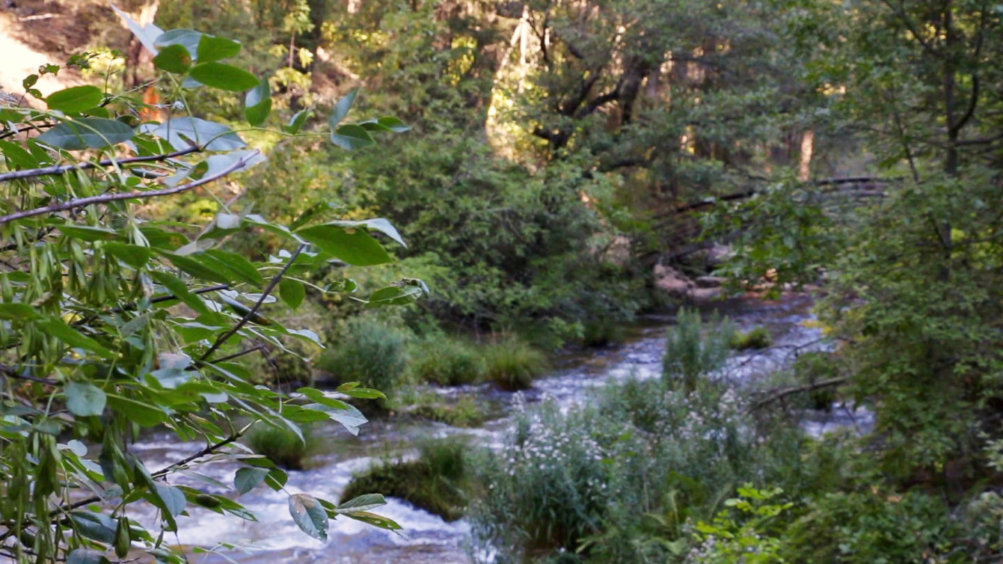
Burney Creek originates from underground springs in the forested uplands of eastern Shasta County. The water sources multiply and the flow gets larger by the time it reaches Burney Falls. After dropping over the massive cliff face, the water continues flowing to Lake Britton.
Hike beyond Burney Falls Observation Point
For many visitors, the pool in front of Burney Falls is the final destination of the hike. From here they turn back and trudge along the same trail to the parking lot. We were the only visitors who hiked the entire Burney Falls Loop Trail on a chilly morning on one of the last days of summer.
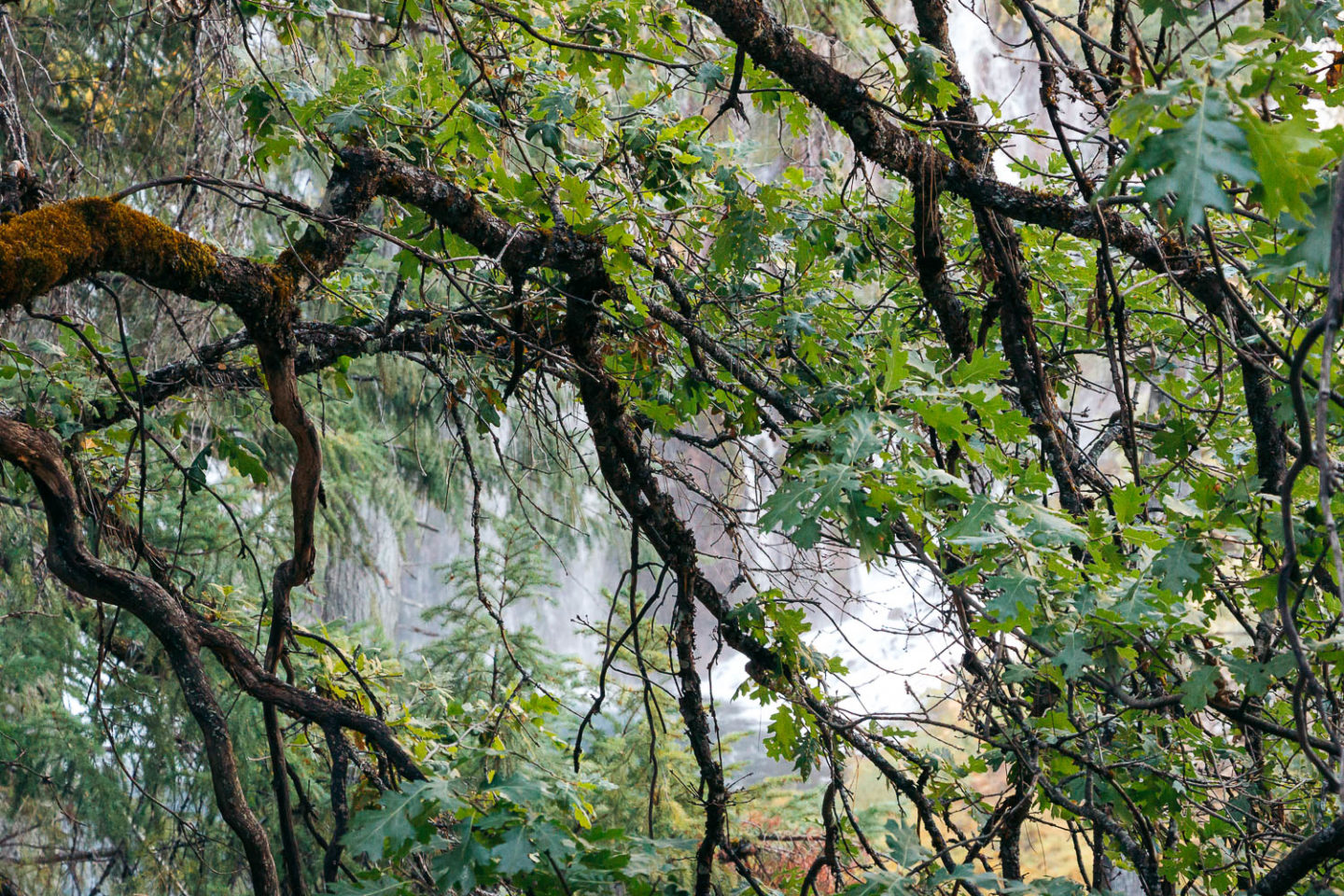
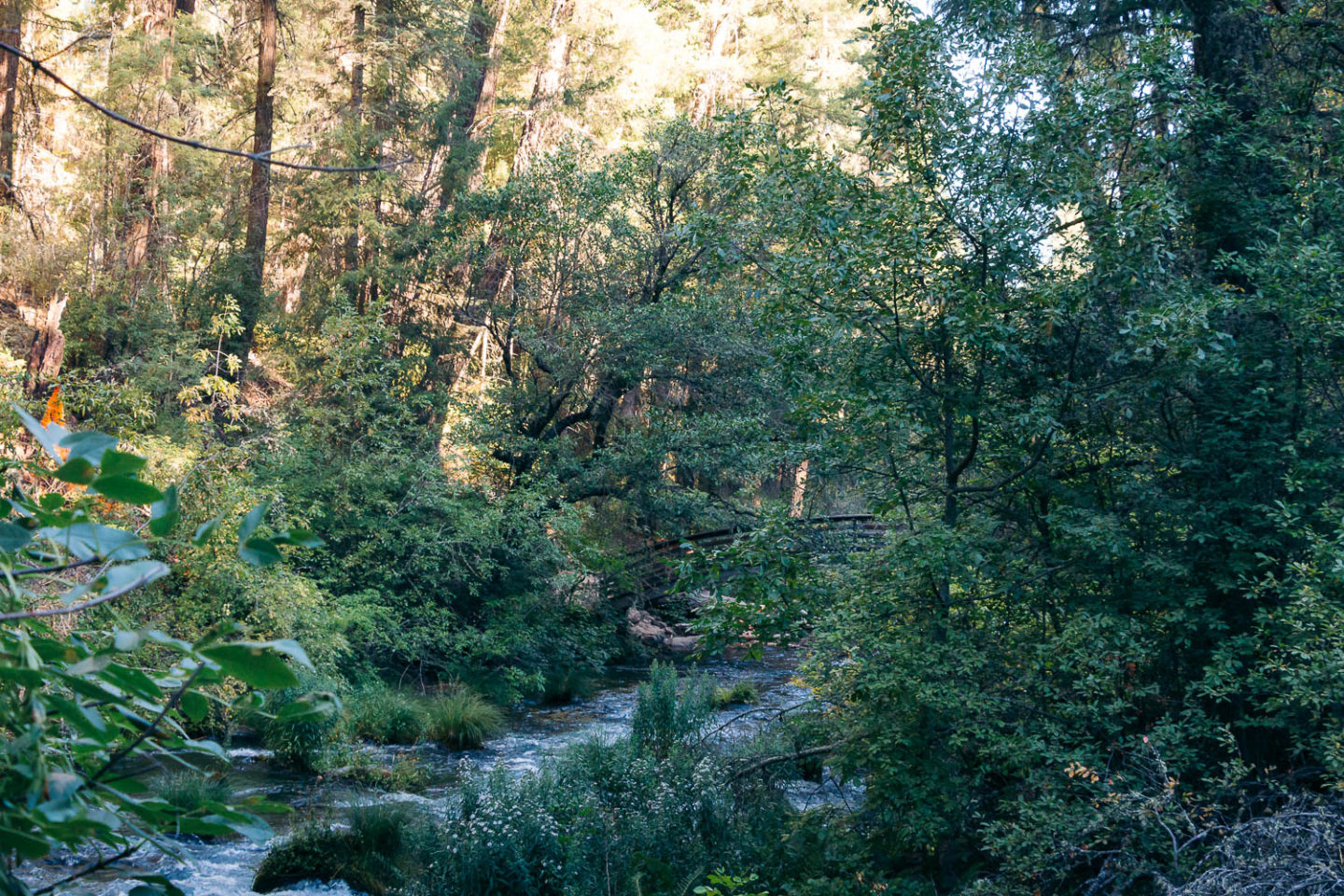
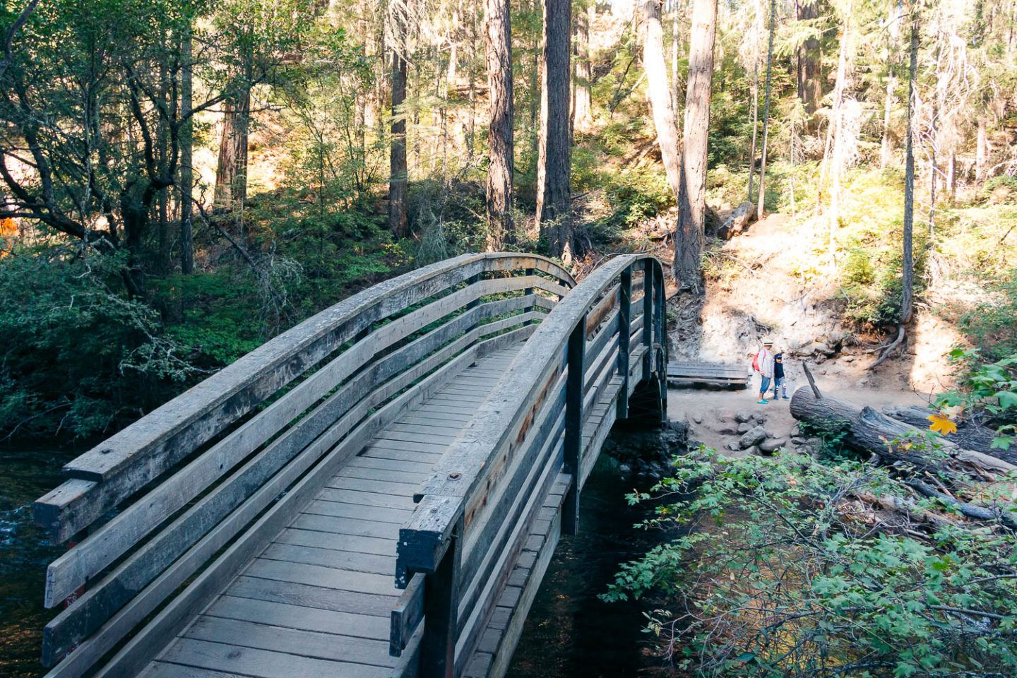
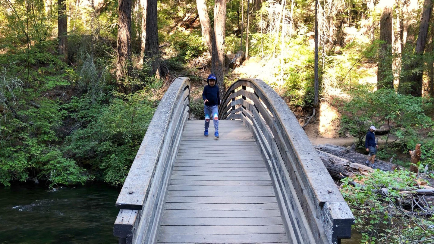
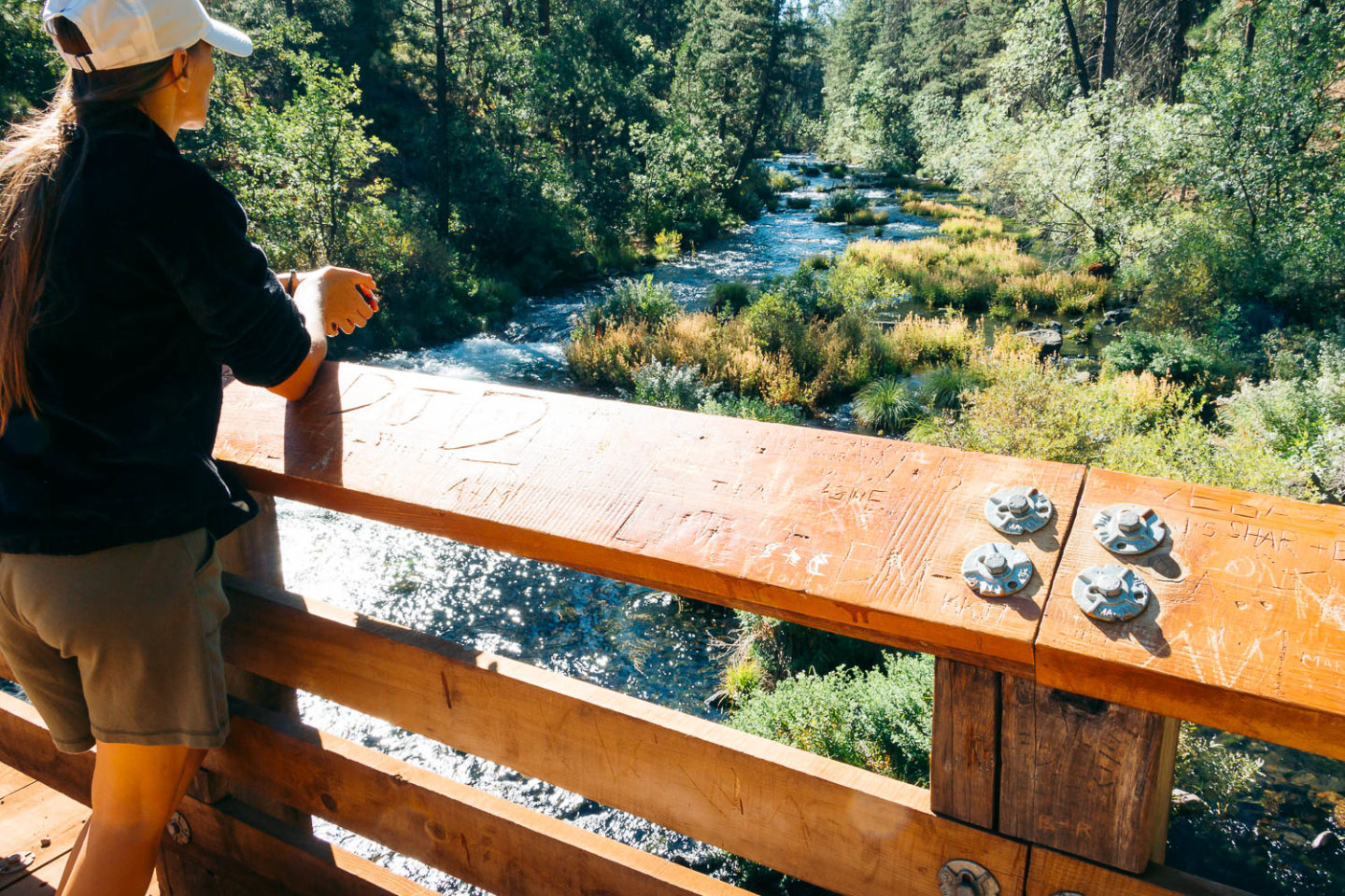
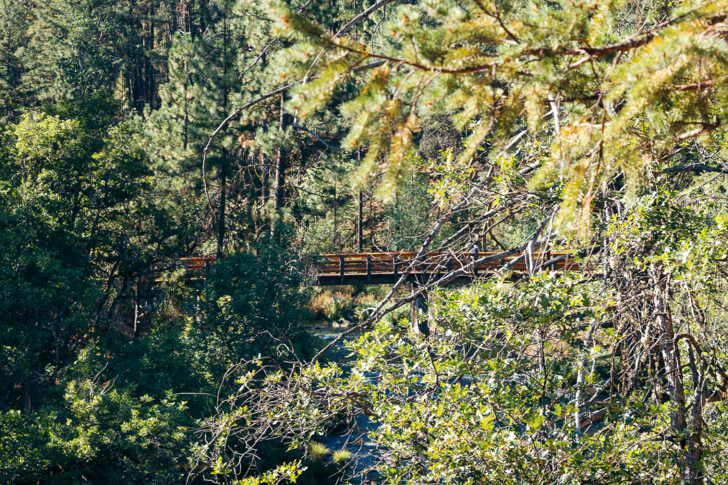
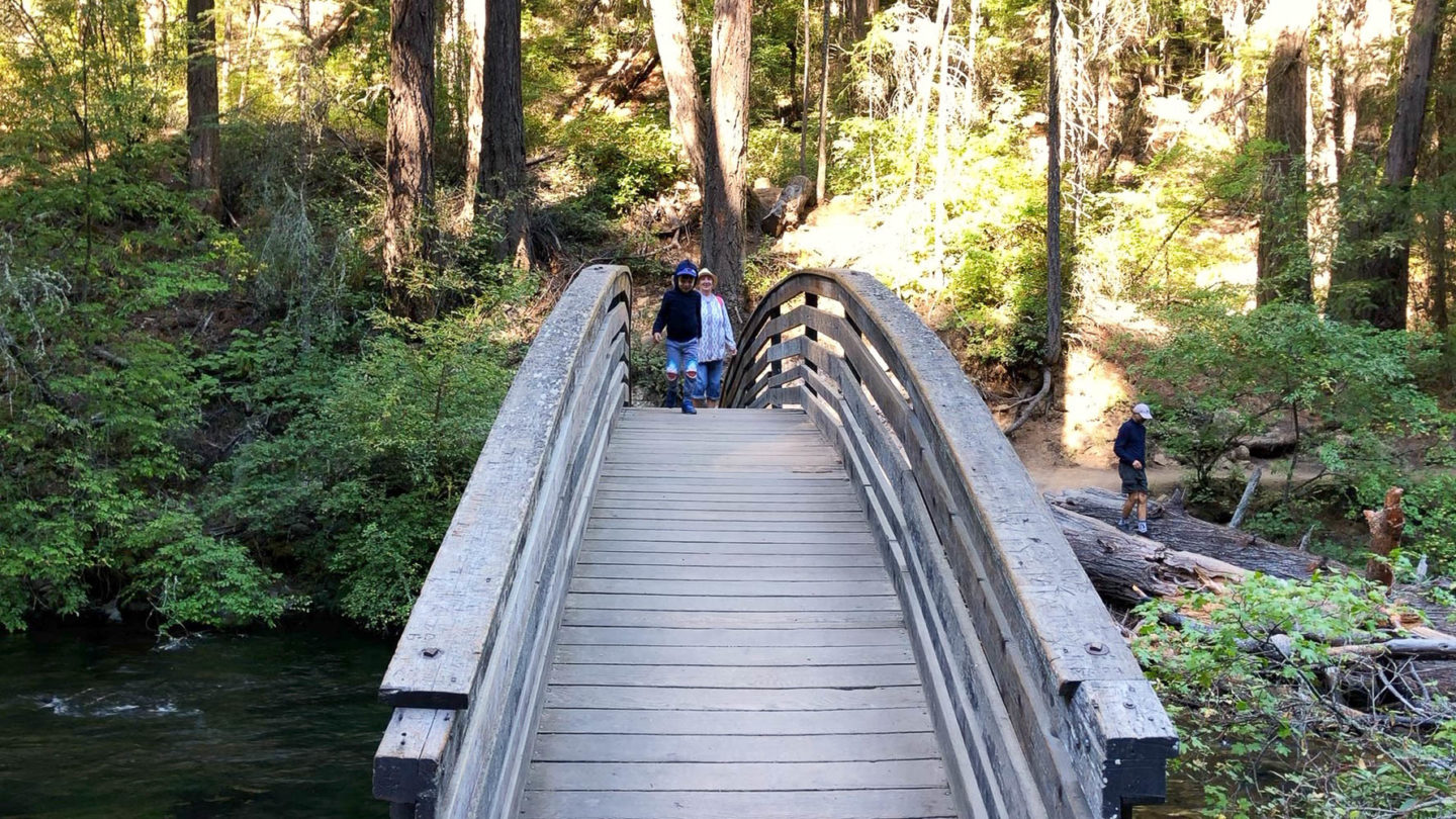
If you take on a challenge and decide to explore the entire loop, continue on along the now narrower trail until you reach the Rainbow Footbridge. The path runs along Burney Creek and is virtually flat at this point. And although you can still hear the gushing waterfall, you can’t see it from this section of the trail.
Once you cross the footbridge, the trail starts ascending. Apart from dense forest and the flowing stream below, no other visible distractions are present at this point.
The hikers get to see Burney Falls once again almost at the end of the loop trail. Soon they come across another footbridge. From here, the trail springs to the right and merges with the trailhead shortly after.
Things to Do in McArthur-Burney Falls Memorial State Park
Hiking
Hiking is the preferred pastime for visitors of McArthur-Burney Falls Memorial State Park. Yet the famous Burney Falls Loop is just one of the trails to explore here. The area features several paths, including the Rim Trail that leads to Lake Britton and a section of the Pacific Crest Trail.
Camping and Canoeing on Lake Britton
If you have the whole day to spent in McArthur-Burney Falls Memorial State Park, take advantage of the pristine, secluded lake overlooked by the majority of the area’s guests. Kayaks, canoes, fishing and paddle boats are available for rent in the park. Check out the Visitor Center for more details.
Fishing
I came across conflicting information when it comes to fishing in McArthur-Burney Falls Memorial State Park. Some sources say you can fish all day long any time of the year while visiting the area.
Signage along the Burney Falls Loop Trail indicates a specific time frame when fishing is allowed. Regardless of this, the visitors of 16 years and older must have a fishing permit.
Swimming
Again some sources insist that swimming is not allowed in the Burney Falls pool. Others, state the opposite. If there is any information about it along the trail, I failed to notice it.
The bottom of the waterfall doesn’t look like an ideal place to swim, though. On top of that, the water temperature lingers around 42 degrees Fahrenheit. So I wouldn’t advise to attempt this freezing-cold dip.
On the other hand, Lake Britton offers incredible opportunities for boating, fishing, and swimming.
Things to Know before Visiting McArthur Burney Falls Memorial State Park
Parking
There is the policy of limiting visitors in place in McArthur-Burney Falls Memorial State Park. While it might be frustrating, its purpose is pretty clear: the park strives to preserve this natural environment for future generations.
With that said, park’s rangers advise the visitors to have a plan B before arriving in McArthur-Burney Falls Memorial State Park. On weekends when the area experiences its highest visitation, the park may be closed several times a day. The visitors are welcome to explore nearby areas before returning back to the waterfall when the parking lot is ready to accommodate new vehicles.
McArthur-Burney Falls Memorial State Park is relatively empty on weekdays. And if you arrive early in the morning, you might have the entire place to yourself or almost to yourself.
Operating Hours
McArthur-Burney Falls Memorial State Park is open for visitors daily, from 8:00 a.m. until sunset.
Admission
Before jumping on the trail leading to Burney Falls, make sure to get your day parking ticket ($10) and place it on the dashboard of your car so it remains visible.
Places to Visit near Burney Falls
Subway Cave
30 minutes from Burney Falls
A tunnel created by lava flow sits roughly 18 miles south of the waterfall and offers a completely different environment. Be sure to bring a flashlight or you may run the risk of getting lost in the pitch-dark cavern.
Lassen Volcanic National Park
46 minutes from Burney Falls
One of the most overlooked national parks in Northern California, Lassen Volcanic astounds the visitors with its hydrothermal features, pristine lakes, and cascading waterfalls.
Mott’s Cottage, Fall River Mills
27 minutes from Burney Falls
If you plan a relaxing weekend getaway, book the Mott’s Cottage in Fall River Mills right now. The rustic Airbnb sits on the 375-acre property, surrounded by rivers and distant Mt. Lassen and Mt. Shasta.
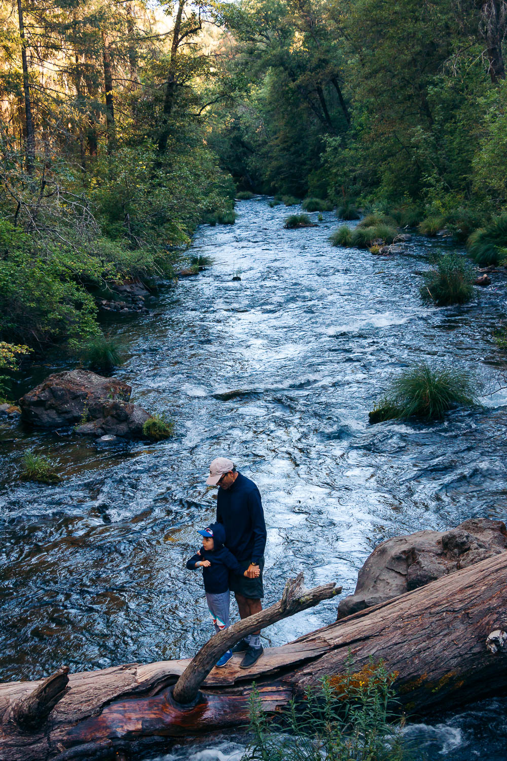
Photo Diary to Inspire You to Visit Burney Falls
Before I conclude this guide to visiting McArthur-Burney Falls Memorial State Park, here is an exclusive photo diary from our trip. I hope these pictures will inspire you to visit the pristine Burney Falls region in the near future.